River_Gade_at_Great_Gaddesden_-_geograph.org.uk_-_1257620.jpg
No higher resolution available.
Summary
| Description |
English:
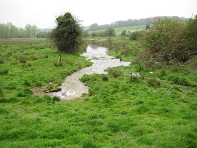
River Gade at Great Gaddesden. Taken from the same viewpoint as
140293
and a little over three years later, the water level in the Gade has risen markedly. A spring in the left foreground is vigorously supplying the river with water, while the main channel of the river from
1257651
flows in at the right. Early 20th century Ordnance Survey maps show that there were watercress beds just downstream of this location on the right side of the river.
|
| Date | |
| Source | From geograph.org.uk |
| Author | Nigel Cox |
|
Attribution
( required by the license ) |
Nigel Cox / River Gade at Great Gaddesden / |
| Camera location |
|
View this and other nearby images on: OpenStreetMap |
|
|---|
_heading:157.00&language=en)
| Object location |
|
View this and other nearby images on: OpenStreetMap |
|
|---|
_heading:157.00&language=en)
Licensing

|
This image was taken from the
Geograph project
collection. See
this photograph's page
on the Geograph website for the photographer's contact details. The copyright on this image is owned by
Nigel Cox
and is licensed for reuse under the
Creative Commons
Attribution-ShareAlike 2.0 license.
|
This file is licensed under the
Creative Commons
Attribution-Share Alike 2.0 Generic
license.
Attribution:
Nigel Cox
-
You are free:
- to share – to copy, distribute and transmit the work
- to remix – to adapt the work
-
Under the following conditions:
- attribution – You must give appropriate credit, provide a link to the license, and indicate if changes were made. You may do so in any reasonable manner, but not in any way that suggests the licensor endorses you or your use.
- share alike – If you remix, transform, or build upon the material, you must distribute your contributions under the same or compatible license as the original.