Roman_Empire_with_dioceses_in_400_AD.png

Size of this preview:
800 × 550 pixels
.
Other resolutions:
320 × 220 pixels
|
640 × 440 pixels
|
1,024 × 704 pixels
|
1,280 × 880 pixels
|
2,042 × 1,404 pixels
.
Summary
| Description |
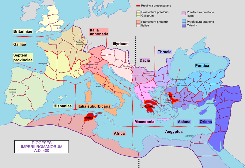
English:
Map of the Roman Empire with its dioceses, in 400 AD.
Français :
Carte de l'Empire romain avec ses diocèses, en 400 ap. J.-C.
|
| Date | 04/03/09 |
| Source | Own work |
| Author | Mandrak |
| Other versions | Blank map : File:Blank Roman Empire.png |
Licensing
|
|
I, the copyright holder of this work, release this work into the
public domain
. This applies worldwide.
In some countries this may not be legally possible; if so: I grant anyone the right to use this work for any purpose , without any conditions, unless such conditions are required by law. |