Rongelap_Atoll_-_2014-12-06_-_Landsat_8_-_15m.png
Size of this preview:
733 × 600 pixels
.
Other resolutions:
294 × 240 pixels
|
587 × 480 pixels
|
939 × 768 pixels
|
1,252 × 1,024 pixels
|
2,504 × 2,048 pixels
|
3,741 × 3,060 pixels
.
Summary
| Description |
English:
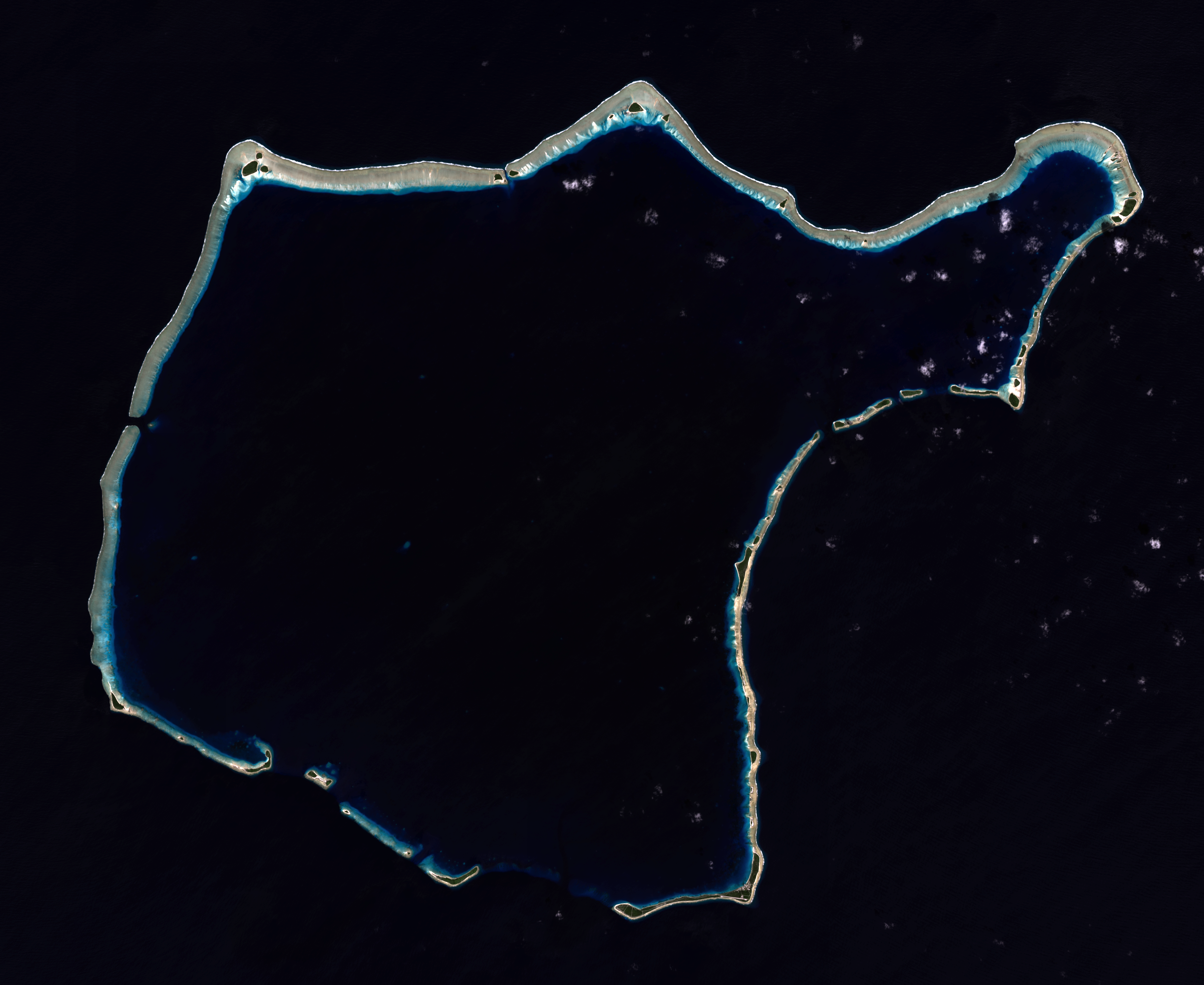
Composite "true color" multispectral satellite image of Rongelap Atoll.
NASA Landsat 8 OLI bands used were 4 (red), 3 (green), 2 (blue). Pan-sharpened with band 8. Manual color balance. Projection: UTM (zone 58), WGS84. Imagery courtesy NASA/USGS. (note: atmospheric haze is present and could not be fully removed) |
| Date | |
| Source | NASA/USGS Landsat satellite image GeoTIFF archive, http://glovis.usgs.gov |
| Author | NASA |
| Camera location |
|
View this and other nearby images on: OpenStreetMap |
|
|---|
Licensing
|
|
This file is in the public domain in the United States because it was solely created by NASA . NASA copyright policy states that "NASA material is not protected by copyright unless noted ". (See Template:PD-USGov , NASA copyright policy page or JPL Image Use Policy .) |
|

|
Warnings:
|