Roszczenia_litewskie.PNG
Size of this preview:
735 × 600 pixels
.
Other resolutions:
294 × 240 pixels
|
589 × 480 pixels
|
977 × 797 pixels
.

|
This
historical map
image could be re-created
using
vector graphics
as an
SVG
file
. This has several advantages; see
Commons:Media for cleanup
for more information. If an SVG form of this image is available, please upload it and afterwards replace this template with
{{

vector version available

|

new image name

}}
.
It is recommended to name the SVG file “Roszczenia litewskie.svg”—then the template Vector version available (or Vva ) does not need the new image name parameter. |
| Description |
English:
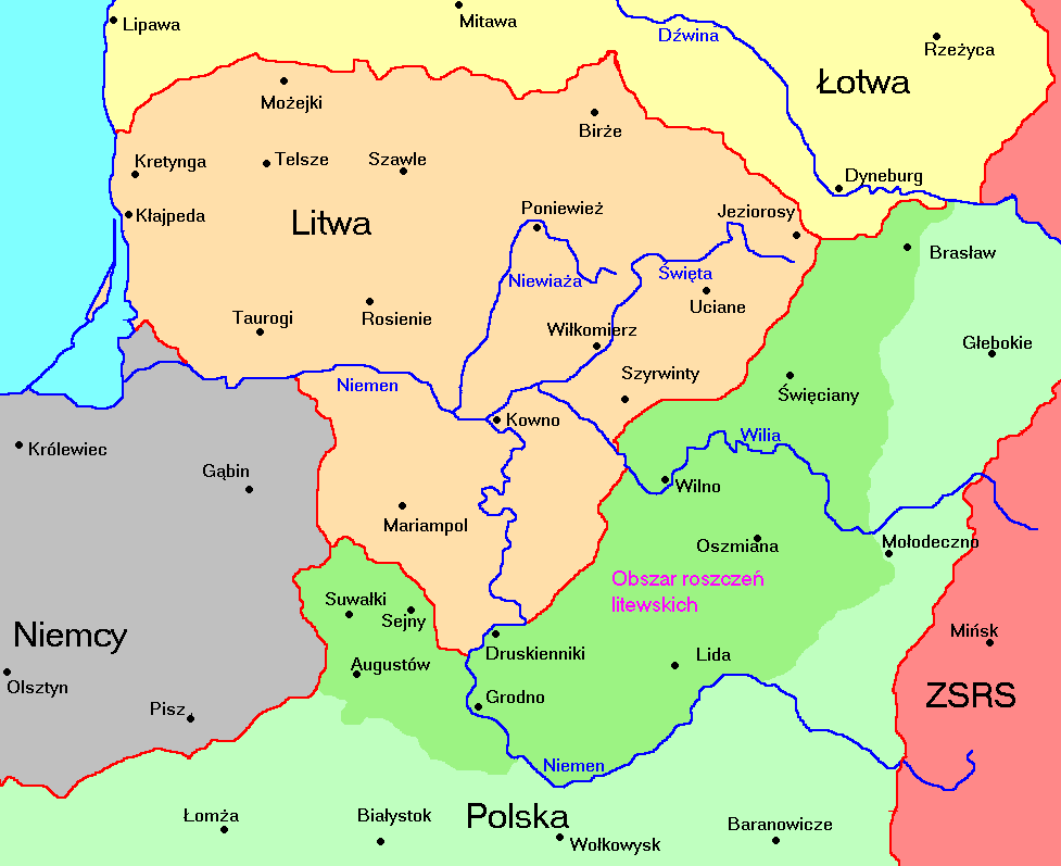
Territories of Lithuania 1920-1940 and Polish terrietories claimed by Lithuania
Polski:
Litwa 1920-1940 i jej roszczenia terytorialne względem Polski
|
||
| Date | |||
| Source | Own work , based on http://3.bp.blogspot.com/_Zt8COHwFWLM/SpBfcaNvb8I/AAAAAAAAAAM/el5F9Cu9ySk/s1600-h/LTU-1920a.gif | ||
| Author | Mix321 | ||
|
Permission
( Reusing this file ) |
I, the copyright holder of this work, hereby publish it under the following license:
|
