Rothenburg_BW_4.JPG

Size of this preview:
800 × 536 pixels
.
Other resolutions:
320 × 214 pixels
|
640 × 428 pixels
|
1,024 × 685 pixels
|
1,280 × 857 pixels
|
2,560 × 1,714 pixels
|
3,872 × 2,592 pixels
.
Summary
| Description |
Deutsch:
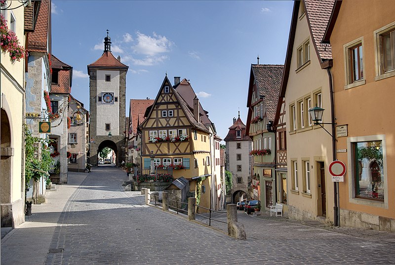
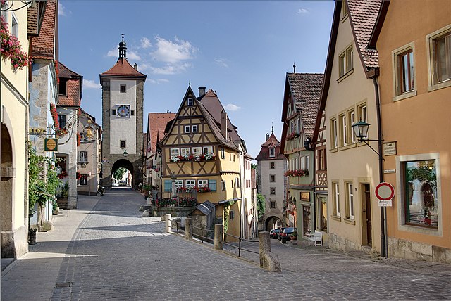
Rothenburg ob der Tauber, Plönlein mit Sieberstor und Kobolzellertor
English:
Rothenburg ob der Tauber, the place is called Plönlein a former marketplace, on the left side the Siebers-gate on the right the Kobolzeller-gate. This is one of the most photographed and painted places in Germany
Français :
Rotemburg sur la Tauber, Place de Plönlein. Cette place était une place de marché. Sur la gauche, on voit la porte Siebers; sur la droite, on voit la porte de Kobolzeller. Cette vue est l'une des plus photographiées et peintes d'Allemagne.
Русский:
Ротенбург-об-дер-Таубер, Пленляйн, бывший рынок. Слева ворота Siebers, справа ворота Kobolzeller. Одно из самых фотографируемых мест в Германии.
|
| Date | |
| Source | Own work |
| Author | Berthold Werner |
| Other versions | http://www.bildindex.de/document/obj20764991?part=0&medium=fm761327 |
| Camera location |
|
View this and other nearby images on: OpenStreetMap |
|
|---|
Licensing
|
|
I, the copyright holder of this work, release this work into the
public domain
. This applies worldwide.
In some countries this may not be legally possible; if so: I grant anyone the right to use this work for any purpose , without any conditions, unless such conditions are required by law. |

|
This image has been assessed under the valued image criteria and is considered the most valued image on Commons within the scope: Plönlein in Rothenburg ob der Tauber . You can see its nomination here . |
|