Ruta_de_Cortés.svg

Size of this PNG preview of this SVG file:
800 × 345 pixels
.
Other resolutions:
320 × 138 pixels
|
640 × 276 pixels
|
1,024 × 441 pixels
|
1,280 × 551 pixels
|
2,560 × 1,103 pixels
|
931 × 401 pixels
.
Summary
| Description |
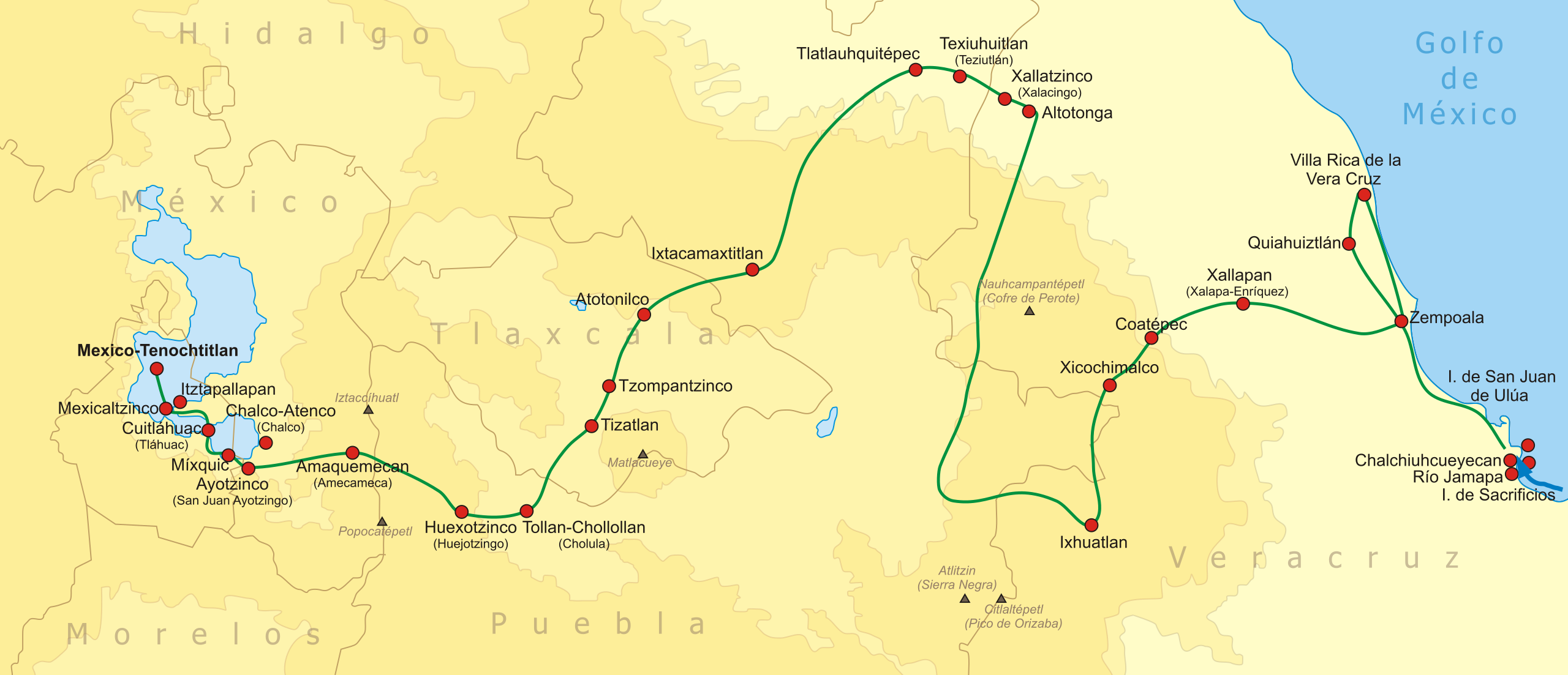
Español:
Ruta seguida por Cortés y sus aliados
desde la costa de Chalchiuhcueyecan hasta México-Tenochtitlan en 1519.
English:
The route of the
Spanish conquest of the Aztec Empire
in central Mexico.
Français :
La
Conquête du Aztec-Mexique
par Hernán Cortés.
|
| Date | |
| Source | Own work |
| Author | Yavidaxiu |
| Other versions |
|

Licensing
I, the copyright holder of this work, hereby publish it under the following licenses:

|
Permission is granted to copy, distribute and/or modify this document under the terms of the GNU Free Documentation License , Version 1.2 or any later version published by the Free Software Foundation ; with no Invariant Sections, no Front-Cover Texts, and no Back-Cover Texts. A copy of the license is included in the section entitled GNU Free Documentation License . |
This file is licensed under the
Creative Commons
Attribution 3.0 Unported
license.
-
You are free:
- to share – to copy, distribute and transmit the work
- to remix – to adapt the work
-
Under the following conditions:
- attribution – You must give appropriate credit, provide a link to the license, and indicate if changes were made. You may do so in any reasonable manner, but not in any way that suggests the licensor endorses you or your use.
You may select the license of your choice.
| Annotations | This image is annotated: View the annotations at Commons |