SST_Gulf_stream.jpeg
Size of this preview:
800 × 492 pixels
.
Other resolutions:
320 × 197 pixels
|
640 × 394 pixels
|
1,024 × 630 pixels
|
1,445 × 889 pixels
.
Summary
| Description |
English:
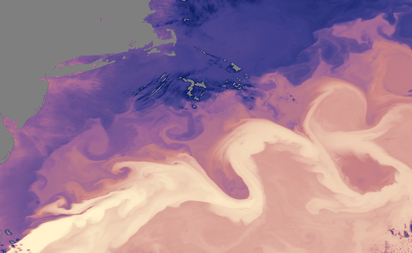
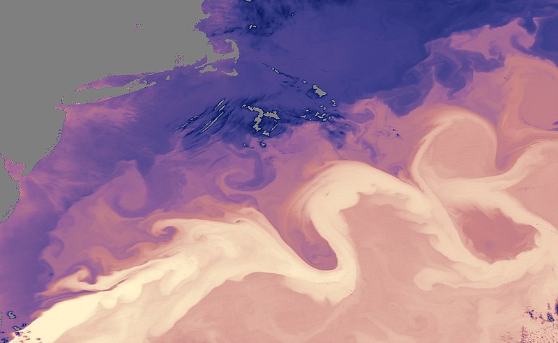
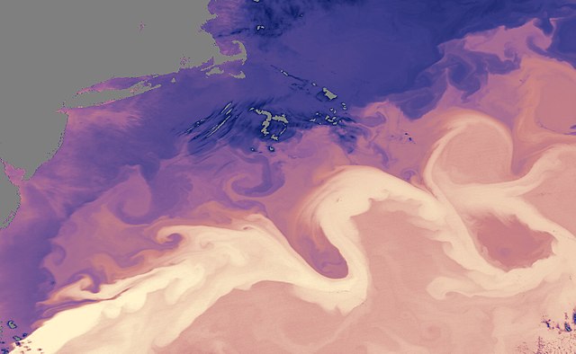
Transport of warm water revealed by the sea surface temperature distribution around the Gulf Stream in 2005. The darkest areas are measured at -1°C, while the warmest areas reach 23°C.
|
| Date | |
| Source | https://earthobservatory.nasa.gov/IOTD/view.php?id=5432 |
| Author | NASA (data collected by the Moderate Resolution Imaging Spectroradiometer (MODIS) on NASA’s Aqua satellite= |
Licensing
|
|
This file is in the public domain in the United States because it was solely created by NASA . NASA copyright policy states that "NASA material is not protected by copyright unless noted ". (See Template:PD-USGov , NASA copyright policy page or JPL Image Use Policy .) |
|

|
Warnings:
|