Santander_Bank_footprint.png
Size of this preview:
800 × 465 pixels
.
Other resolutions:
320 × 186 pixels
|
640 × 372 pixels
|
1,024 × 596 pixels
|
1,280 × 745 pixels
|
2,166 × 1,260 pixels
.
Summary
| Description |
English:
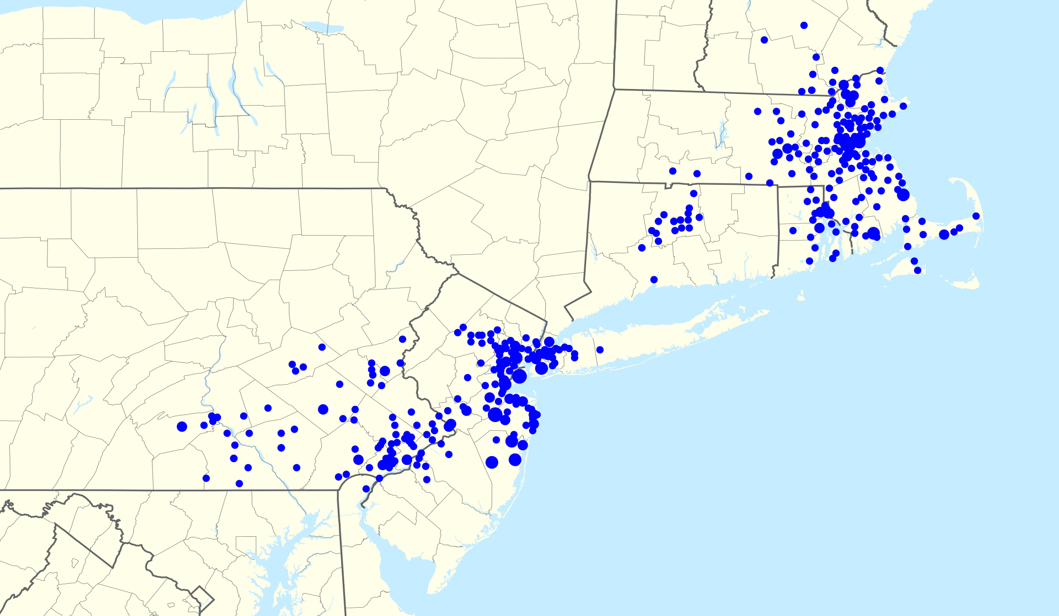
Footprint of
Sovereign Bank
branches within the eastern seaboard of the
United States
. Zip codes with more than one branch have progressively larger points.
|
| Date | |
| Source | I created this work entirely by myself; any US states in this image is derived from the corresponding image in category:Location maps of the United States . To specify: the exact file within that category will be derived from File:USA_X_location_map.svg where X is the state (e.g., File:USA_Alabama_location_map.svg ). |
| Author | Magog the Ogre ( talk ) |
|
|
Point Maps
══▻ FAQ ◅══ ══▻ Create your own ◅══ |
Licensing
This file is licensed under the
Creative Commons
Attribution-Share Alike 3.0 Unported
license.
-
You are free:
- to share – to copy, distribute and transmit the work
- to remix – to adapt the work
-
Under the following conditions:
- attribution – You must give appropriate credit, provide a link to the license, and indicate if changes were made. You may do so in any reasonable manner, but not in any way that suggests the licensor endorses you or your use.
- share alike – If you remix, transform, or build upon the material, you must distribute your contributions under the same or compatible license as the original.
Original upload log
The original description page was
here
. All following user names refer to en.wikipedia.
- 2010-08-06 20:31 Magog the Ogre 1076×610× (213578 bytes) {{Information |Description=Footprint of [[Sovereign Bank]] branches within western [[Pennsylvania]] and eastern [[Ohio]]. Zip codes with more than one branch have progressively larger points. |Source=I created this work entirely by myself; any US states \