Scandinavia_M2002074_lrg.jpg

Size of this preview:
463 × 599 pixels
.
Other resolutions:
185 × 240 pixels
|
371 × 480 pixels
|
593 × 768 pixels
|
791 × 1,024 pixels
|
1,582 × 2,048 pixels
|
6,800 × 8,800 pixels
.
| Warning | The original file is very high-resolution. It might not load properly or could cause your browser to freeze when opened at full size. |
|---|
| Description |
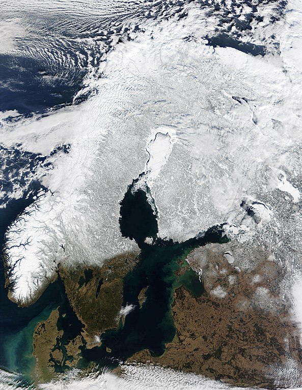
English:
Snow Cover Across Scandinavia
. In this mostly cloud-free true-color scene, much of Scandinavia can be seen to be still covered by snow. From left to right across the top of this image are the countries of
Norway
,
Sweden
,
Finland
, and northwestern
Russia
. The
Baltic Sea
is located in the bottom center of this scene, with the Gulf of Bothnia to the north (in the center of this scene) and the Gulf of Finland to the northeast.
|
| Date | |
| Source |
Moderate-resolution Imaging Spectroradiometer (MODIS), flying aboard NASA's Terra satellite.
http://earthobservatory.nasa.gov/NaturalHazards/natural_hazards_v2.php3?img_id=2611 |
| Author | Image courtesy Jacques Descloitres, MODIS Land Rapid Response Team at NASA GSFC |
|
|
This file is in the public domain in the United States because it was solely created by NASA . NASA copyright policy states that "NASA material is not protected by copyright unless noted ". (See Template:PD-USGov , NASA copyright policy page or JPL Image Use Policy .) |
|

|
Warnings:
|