Scg02.png

Size of this preview:
381 × 599 pixels
.
Other resolutions:
152 × 240 pixels
|
305 × 480 pixels
|
818 × 1,287 pixels
.
Summary
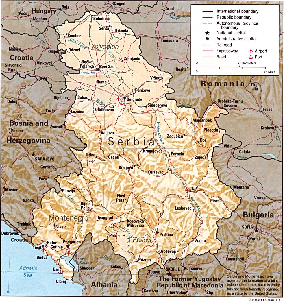
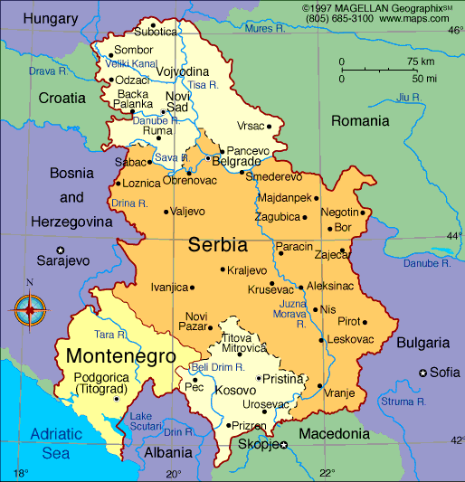
- English: Federal Republic of Yugoslavia (1992-2003) and Serbia and Montenegro (2003-2006).
- Serbian: Savezna Republika Jugoslavija (1992-2003) i Srbija i Crna Gora (2003-2006).
References
- Slobodan Radovanović, Geografski atlas, Magic Map, Smederevska Palanka, 2001.
- Školski geografski atlas, Intersistem Kartografija, Beograd, 2004.
- Miodrag Milošević, Geografija za 8. razred osnovne škole, Beograd, 1994.
- Istorijski atlas, Zavod za kartografiju "Geokarta", Beograd, 1999.
- Denis Šehić - Demir Šehić, Istorijski atlas sveta, Beograd, 2007.
- http://www.lib.utexas.edu/maps/europe/serbia.jpg
- http://www.geographicguide.net/europe/maps-europe/maps/serbia-montenegro.gif
- http://i.infoplease.com/images/myugo.gif
- http://poincare.matf.bg.ac.rs/~geom_workshop/yu1.jpg
Source and licence
Self-made map by PANONIAN
|
|
This work has been released into the
public domain
by its author,
PANONIAN
. This applies worldwide.
In some countries this may not be legally possible; if so:
|

|
This map has been uploaded by
Electionworld
from en.wikipedia.org to enable the
|