Second_world_war_asia_1937-1942_map_en6.png
Size of this preview:
780 × 600 pixels
.
Other resolutions:
312 × 240 pixels
|
624 × 480 pixels
|
999 × 768 pixels
|
1,298 × 998 pixels
.
Summary
| Description |
English:
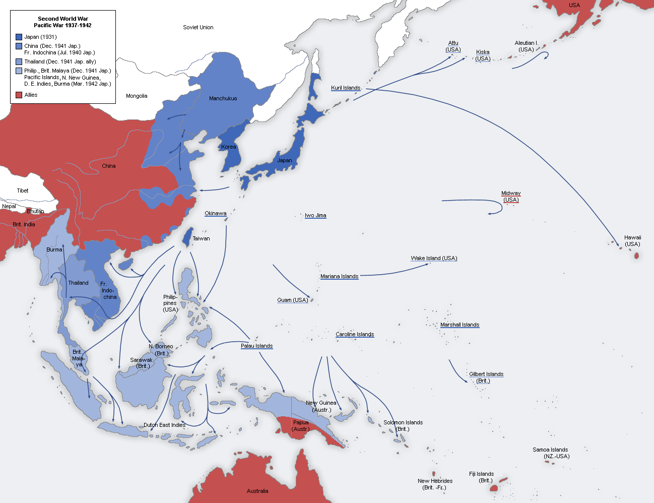
A map of the Japanese advance from 1937 to 1942.
日本語:
日本による占領地域の拡大(1937年から1942年)
|
| Date |
Original Image:
22 August 2005
Derivative Image: 31 July 2011 |
| Source |
This file was derived from:
Second world war asia 1937-1942 map de.png
|
| Author |
Original Author:
User:San Jose
Derivative Author: Dead Mary |
|
Permission
( Reusing this file ) |
This image is a translation of the original, created and released under the terms of the GNU Free Documentation License. |
Licensing

|
Permission is granted to copy, distribute and/or modify this document under the terms of the GNU Free Documentation License , Version 1.2 or any later version published by the Free Software Foundation ; with no Invariant Sections, no Front-Cover Texts, and no Back-Cover Texts. A copy of the license is included in the section entitled GNU Free Documentation License . |
|
|
This file is licensed under the Creative Commons Attribution-Share Alike 3.0 Unported license. | |
|
||
| This licensing tag was added to this file as part of the GFDL licensing update . |