Sembach_Air_Base_aerial_view_1989.JPEG

Size of this preview:
800 × 528 pixels
.
Other resolutions:
320 × 211 pixels
|
640 × 422 pixels
|
1,024 × 676 pixels
|
1,280 × 845 pixels
|
1,802 × 1,189 pixels
.
Summary
| Description |
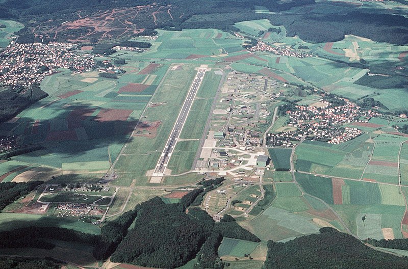
An aerial view of the U.S. Air Force Sembach Air Base, Rheinland-Pfalz, Germany.
Note : In the official description, the air base is wrongly identified as Spangdahlem Air Base. Check the satellite photo to see that Sembach has not changed much since the 1980s. Easiest to identify is the large hangar. |
| Date | |
| Source | U.S. DefenseImagery photo VIRIN: DF-ST-91-11503 |
| Author | MSgt. Bill Thompson, USAF |
| Camera location |
|
View this and other nearby images on: OpenStreetMap |
|
|---|
Licensing
|
|
This image or file is a work of a
U.S. Air Force
Airman or employee, taken or made as part of that person's official duties. As a
work
of the
U.S. federal government
, the image or file is in the
public domain
in the United States.
|

|