Serbia_Map_including_with_de_facto_regime.png

Size of this preview:
478 × 599 pixels
.
Other resolutions:
191 × 240 pixels
|
383 × 480 pixels
|
613 × 768 pixels
|
817 × 1,024 pixels
|
2,502 × 3,135 pixels
.

|
This
map
image could be re-created
using
vector graphics
as an
SVG
file
. This has several advantages; see
Commons:Media for cleanup
for more information. If an SVG form of this image is available, please upload it and afterwards replace this template with
{{

vector version available

|

new image name

}}
.
It is recommended to name the SVG file “Serbia Map including with de facto regime.svg”—then the template Vector version available (or Vva ) does not need the new image name parameter. |
| Description |
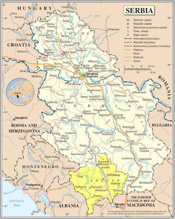
English:
Map of Serbia with Kosovo included, changed, de facto regime inner Serbia
|
|||
| Date | ||||
| Source | The Cartographic Section of the United Nations (CSUN) http://www.un.org/Depts/Cartographic/map/profile/serbia.pdf | |||
| Author | Cartographer of the United Nations | |||
|
Permission
( Reusing this file ) |
|
