Shipwrecks_in_Ironbottom_Sound,_Solomon_Islands.png
Size of this preview:
800 × 547 pixels
.
Other resolutions:
320 × 219 pixels
|
640 × 438 pixels
|
1,024 × 700 pixels
|
1,280 × 875 pixels
|
1,541 × 1,054 pixels
.
Summary
| Description |
English:
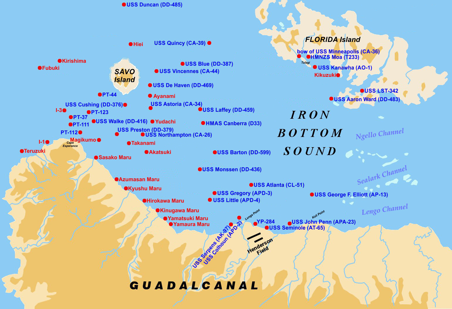
Map of the location of World War II shipwrecks in Ironbottom Sound in the Solomon Islands. Some wreck positions are not exactly known.
|
| Date | |
| Source | Wrecks_in_the_Ironbottom_Sound.jpg |
| Author | User:W.wolny , file Wrecks_in_the_Ironbottom_Sound.jpg , uploaded from German wikipedia by Vvulto ; new version uploaded by Cobatfor , 2014-07-02. |
| Other versions | Derivative works of this file: Wrecks in the Ironbottom Sound.jpg |
Licensing
This file is licensed under the
Creative Commons
Attribution-Share Alike 3.0 Unported
license.
-
You are free:
- to share – to copy, distribute and transmit the work
- to remix – to adapt the work
-
Under the following conditions:
- attribution – You must give appropriate credit, provide a link to the license, and indicate if changes were made. You may do so in any reasonable manner, but not in any way that suggests the licensor endorses you or your use.
- share alike – If you remix, transform, or build upon the material, you must distribute your contributions under the same or compatible license as the original.
Original upload log
This image is a derivative work of the following images:
-
File:Wrecks_in_the_Ironbottom_Sound.jpg
licensed with Cc-by-sa-3.0-migrated, GFDL
- 2005-06-04T14:41:18Z Vvulto 1541x1054 (209997 Bytes) Map of the location of shipwrecks in the [[Ironbottom Sound]] in the [[Solomon Islands]]. [[Category:Solomon Islands]] {{GFDL}}