Sino-Indian_Geography.png
Size of this preview:
800 × 565 pixels
.
Other resolutions:
320 × 226 pixels
|
640 × 452 pixels
|
918 × 648 pixels
.
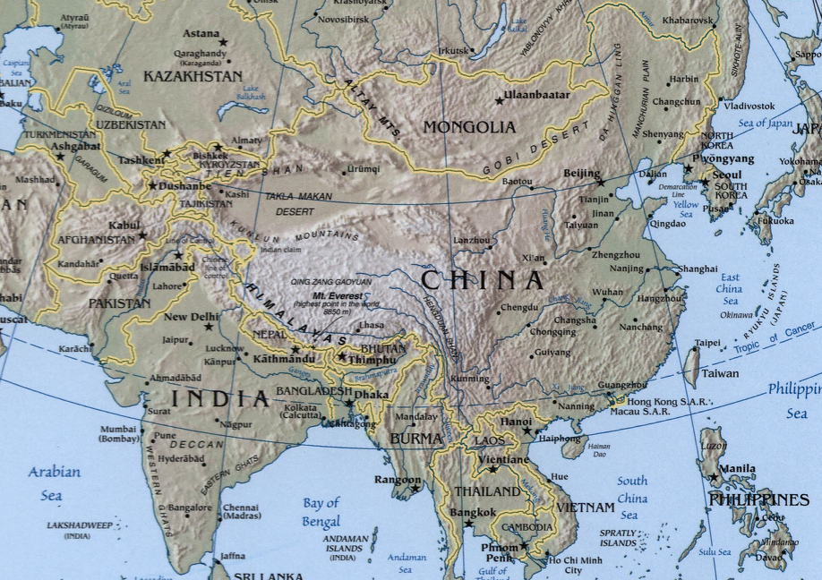
A map showing the geography of the Sino- Indian region.
A physical map with relief showing shading. Scale 1:48,000,000 ; Azimuthal equal-area projection (W 50--W 1650/N 880--S 180).
Cropped from a larger map showing Asia - which may be found on the Library of Congress website (the source image) or alternatively on the CIA World Factbook .
Image created and published by the Central Intelligence Agency of the United States of America in 2004 .
Note
The land border between the China and India over Arunachal Pradesh / South Tibet reflects actual control, without dotted line showing claims
|
|
This image is in the
public domain
because it contains materials that originally came from the United States
Central Intelligence Agency
's
World Factbook
.
|

|