South_America_southern_tip_pol.png

Size of this preview:
800 × 494 pixels
.
Other resolutions:
320 × 198 pixels
|
640 × 395 pixels
|
1,024 × 632 pixels
|
1,280 × 790 pixels
|
2,560 × 1,581 pixels
|
3,859 × 2,383 pixels
.
Summary
| Description |
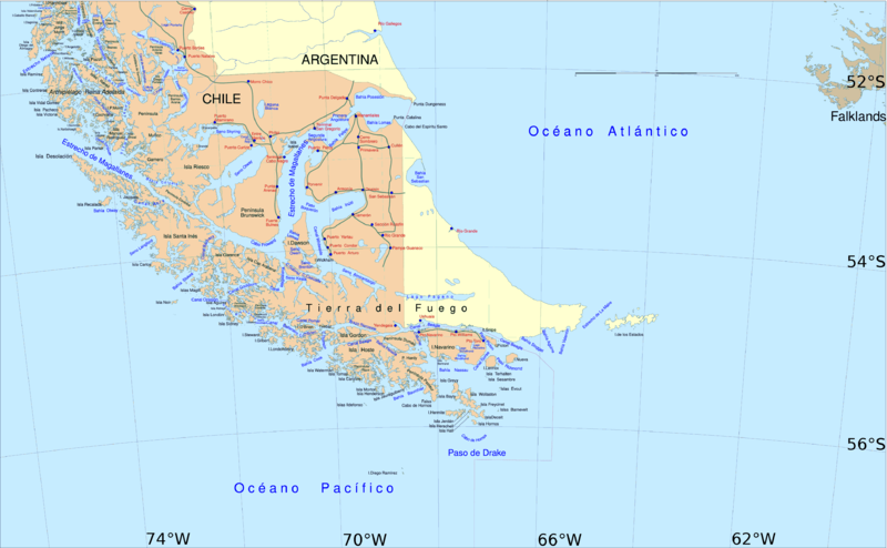
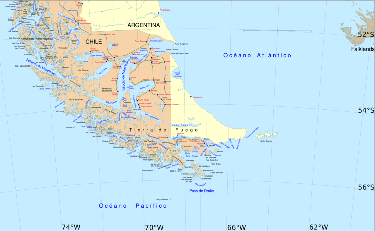
English:
Political map of southern Chile and Argentina, from Straits of Magellan to Cape Horn.
Español:
Mapa político del sur de Chile y la Argentina, entre el estrecho de Magallanes y el cabo de Hornos.
|
||||
| Date | |||||
| Source | File:Sur2.gif | ||||
| Author | User:Createaccount | ||||
|
Permission
( Reusing this file ) |
|
||||
| Other versions | Derivative works of this file: Metula.svg |
Licensing

|
Permission is granted to copy, distribute and/or modify this document under the terms of the GNU Free Documentation License , Version 1.2 or any later version published by the Free Software Foundation ; with no Invariant Sections, no Front-Cover Texts, and no Back-Cover Texts. A copy of the license is included in the section entitled GNU Free Documentation License . |
|
|
This file is licensed under the Creative Commons Attribution-Share Alike 3.0 Unported license. | |
|
||
| This licensing tag was added to this file as part of the GFDL licensing update . |