South_of_Starvation_State_Park,_Utah.jpg
Size of this preview:
435 × 599 pixels
.
Other resolutions:
174 × 240 pixels
|
349 × 480 pixels
|
558 × 768 pixels
|
1,219 × 1,678 pixels
.
Summary
| Description |
English:
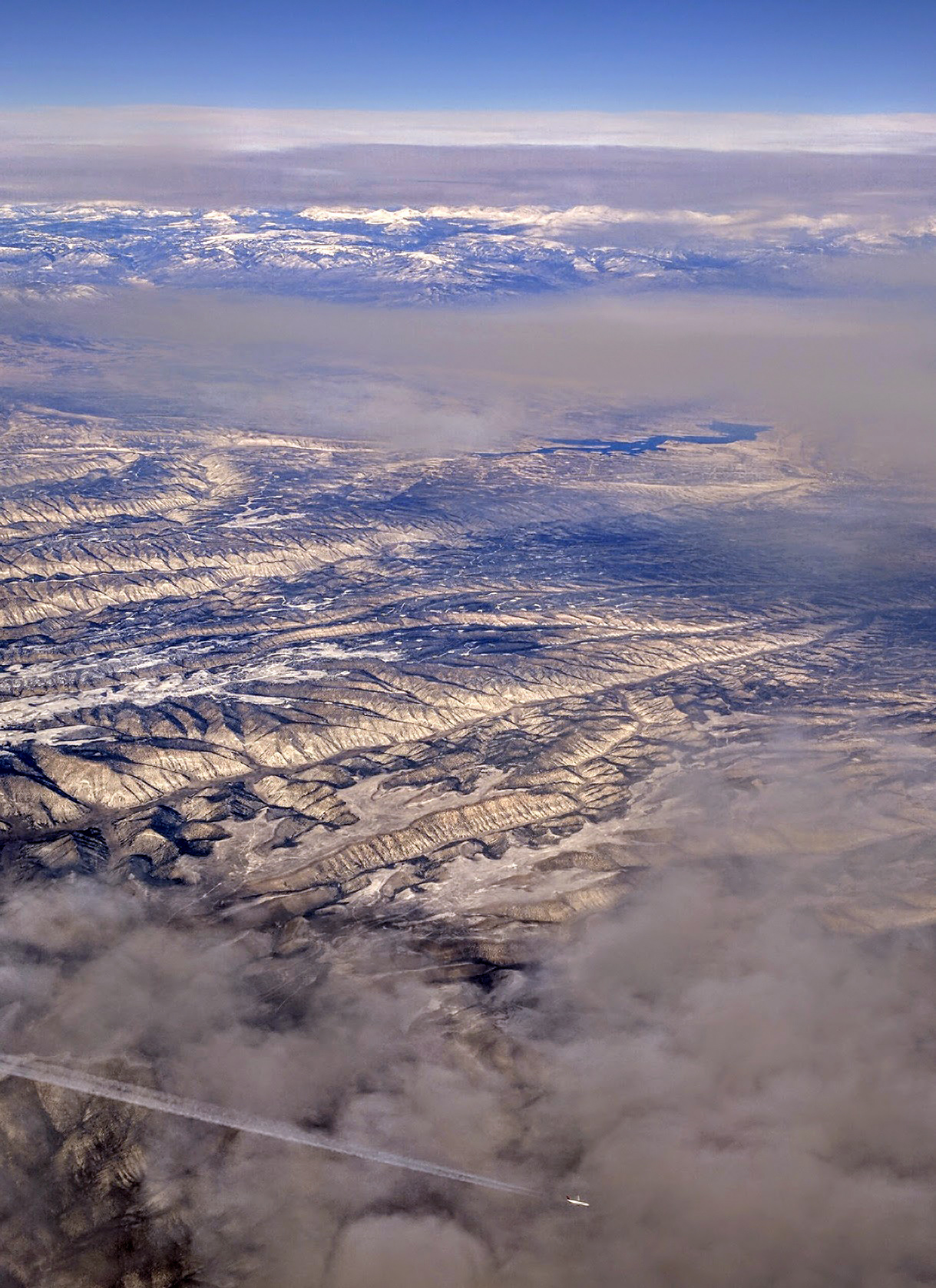
Aerial view of the region south of the Starvation Reservoir and Starvation State Park in Utah. Oil and oil shale drilling platforms dot the landscape. Another jetliner is visible crossing path below this one at 39,000 feet.
|
| Date | |
| Source | Own work |
| Author | Dicklyon |
| Camera location |
|
View this and other nearby images on: OpenStreetMap |
|
|---|
Licensing
I, the copyright holder of this work, hereby publish it under the following license:
This file is licensed under the
Creative Commons
Attribution-Share Alike 4.0 International
license.
-
You are free:
- to share – to copy, distribute and transmit the work
- to remix – to adapt the work
-
Under the following conditions:
- attribution – You must give appropriate credit, provide a link to the license, and indicate if changes were made. You may do so in any reasonable manner, but not in any way that suggests the licensor endorses you or your use.
- share alike – If you remix, transform, or build upon the material, you must distribute your contributions under the same or compatible license as the original.