Souththailandmap.svg

Size of this PNG preview of this SVG file:
800 × 600 pixels
.
Other resolutions:
320 × 240 pixels
|
640 × 480 pixels
|
1,024 × 768 pixels
|
1,280 × 960 pixels
|
2,560 × 1,920 pixels
|
960 × 720 pixels
.
Summary
| Description |
English:
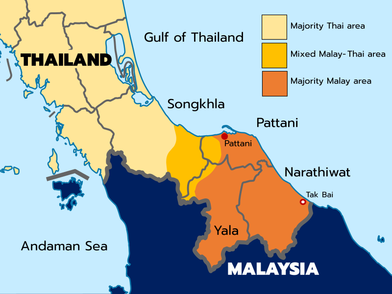
Map of Southern Thailand showing ethnic distribution
|
| Date | |
| Source | Own work based on File:Souththailandmap.GIF , recreated using File:BlankMap-Thailand-provinces.svg |
| Author | Original map made by Electionworld , SVG map made by ILikelargeFries , Blank map made by Paul_012 and NordNordWest |
| Other versions | File:Souththailandmap.GIF |
Licensing
I, the copyright holder of this work, hereby publish it under the following license:
This file is licensed under the
Creative Commons
Attribution 4.0 International
license.
-
You are free:
- to share – to copy, distribute and transmit the work
- to remix – to adapt the work
-
Under the following conditions:
- attribution – You must give appropriate credit, provide a link to the license, and indicate if changes were made. You may do so in any reasonable manner, but not in any way that suggests the licensor endorses you or your use.