Southwyck_House,_Brixton_-_geograph.org.uk_-_220874.jpg
No higher resolution available.
Summary
| Description |
English:
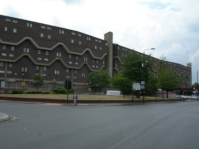
Southwyck House, Brixton. This block of flats is on Coldharbour Lane SW9, very near Brixton town centre. It is known locally as the Barrier Block and it has had an interesting history. Click here
http://www.urban75.org/brixton/features/barrier.html
for an excellent website that tells more. The reason why the block was built to look like that was to deflect traffic noise from a proposed multi lane highway that was never built.
|
| Date | |
| Source | From geograph.org.uk |
| Author | Danny Robinson |
| Camera location |
|
View this and other nearby images on: OpenStreetMap |
|
|---|
_heading:225.00&language=en)
| Object location |
|
View this and other nearby images on: OpenStreetMap |
|
|---|
_heading:225.00&language=en)
Licensing

|
This image was taken from the
Geograph project
collection. See
this photograph's page
on the Geograph website for the photographer's contact details. The copyright on this image is owned by
Danny Robinson
and is licensed for reuse under the
Creative Commons
Attribution-ShareAlike 2.0 license.
|
This file is licensed under the
Creative Commons
Attribution-Share Alike 2.0 Generic
license.
Attribution:
Danny Robinson
-
You are free:
- to share – to copy, distribute and transmit the work
- to remix – to adapt the work
-
Under the following conditions:
- attribution – You must give appropriate credit, provide a link to the license, and indicate if changes were made. You may do so in any reasonable manner, but not in any way that suggests the licensor endorses you or your use.
- share alike – If you remix, transform, or build upon the material, you must distribute your contributions under the same or compatible license as the original.