Spanish_State.png
Size of this preview:
600 × 600 pixels
.
Other resolutions:
240 × 240 pixels
|
480 × 480 pixels
|
768 × 768 pixels
|
1,024 × 1,024 pixels
|
2,000 × 2,000 pixels
.
Summary
| Description |
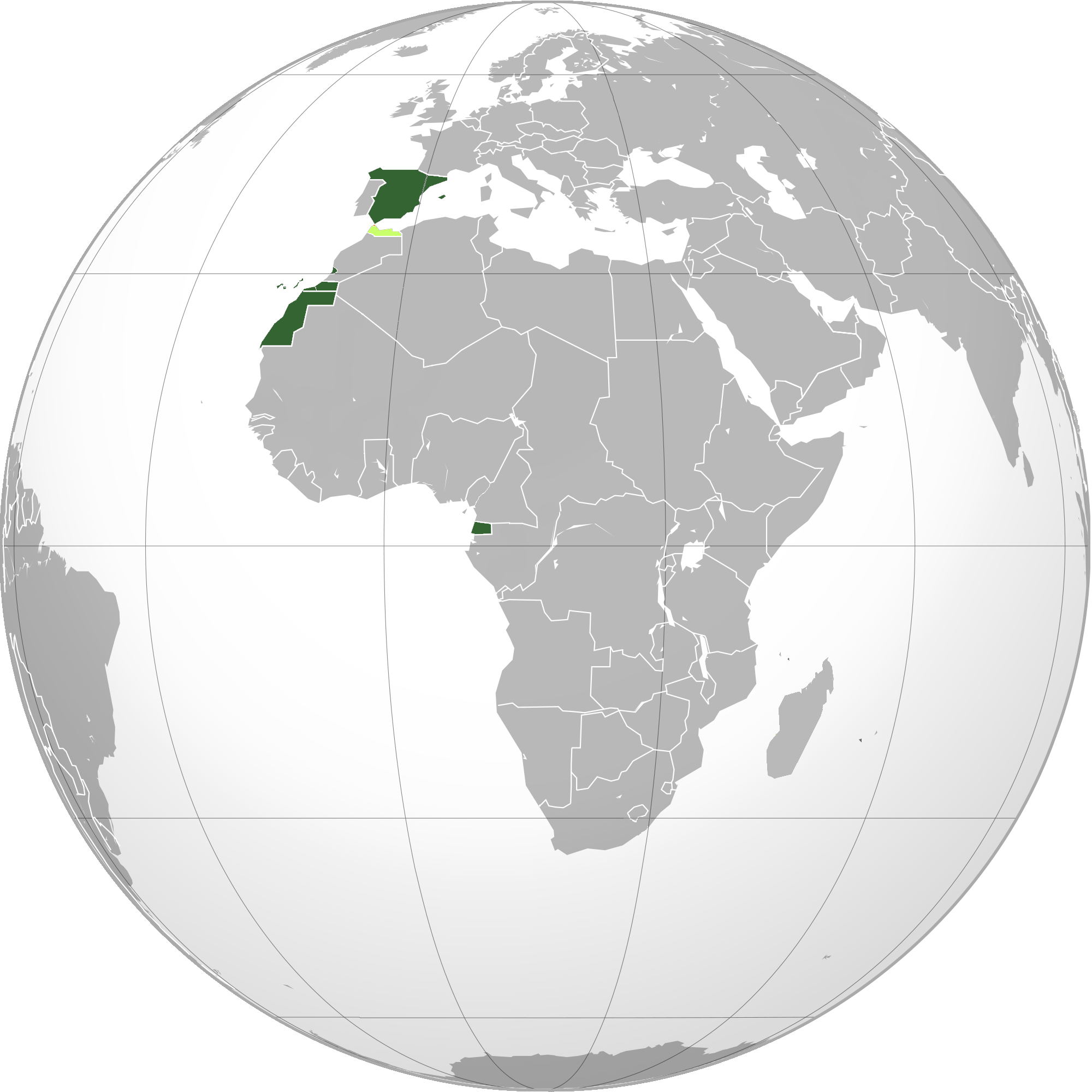
English:
Green
:Map of the Spanish State (includes
overseas provinces
)
Lime : Protectorates Orange : Joint administrations |
| Date | 4 June 2010 (original upload date) |
| Source | Transferred from en.wikipedia to Commons by Oren_neu_dag using CommonsHelper . |
| Author | VoodooIsland at English Wikipedia |
Licensing
|
|
This work has been released into the
public domain
by its author,
VoodooIsland
at
English Wikipedia
. This applies worldwide.
In some countries this may not be legally possible; if so: VoodooIsland grants anyone the right to use this work for any purpose , without any conditions, unless such conditions are required by law. |
Original upload log
The original description page was
here
. All following user names refer to en.wikipedia.
- 2010-06-04 03:31 VoodooIsland 2000×2000× (608154 bytes) '''Green''': Spanish State (includes [[Provinces of Spain|overseas provinces]])<br>'''Lime''': [[Spanish Morocco|Protectorates]]<br>'''Orange''': [[Tangier|Joint administrations]]