Spb_06-2017_img01_Spit_of_Vasilievsky_Island.jpg

Size of this preview:
800 × 533 pixels
.
Other resolutions:
320 × 213 pixels
|
640 × 427 pixels
|
1,024 × 683 pixels
|
1,280 × 853 pixels
|
2,560 × 1,707 pixels
|
4,258 × 2,839 pixels
.
| Description |
English:
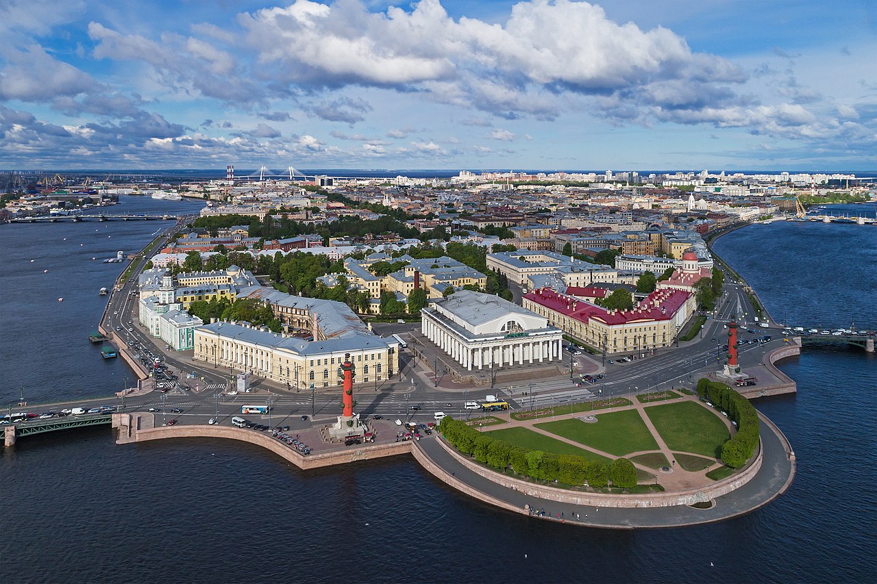
Aerial photo of the Vasilievsky Island Spit in Saint Petersburg (Russia).
Polski:
Widok z lotu ptaka na wschodni cypel Wyspy Wasylewskiej (
ros.
Стрелка Васильевского острова
) w
Petersburgu
, w
Rosji
.
Русский:
Аэрофотосъёмка Стрелки Васильевского острова в Санкт-Петербурге (Россия).
Nederlands:
Het Vasiljevski-eiland in de Russische stad
Sint-Petersburg
|
| Date | |
| Source | Own work |
| Author | A.Savin |
|
Permission
( Reusing this file ) |
.svg)
Just attribute the author: « A.Savin, Wikipedia »; if you have questions —
Telegram
, or e-mail to
[email protected]
.
.svg)
Просто укажите в качестве автора: « А.Савин, Википедия »; если есть вопрос —
телеграм
, или эл.почта на
[email protected]
.

Kennzeichnen Sie einfach als Autor: « A.Savin, Wikipedia »; falls Sie Fragen haben —
Telegram
, oder E-Mail an
[email protected]
.
Thank you. |
| Camera location |
|
View this and other nearby images on: OpenStreetMap |
|
|---|
|
|
|
This image was selected as
picture of the day
on Wikimedia Commons for
8 February 2019
. It was captioned as follows:
Other languages:
Nederlands
:
Het Vasiljevski-eiland in de Russische stad
Sint-Petersburg
Polski
:
Widok z lotu ptaka na wschodni cypel Wyspy Wasylewskiej (
ros.
Стрелка Васильевского острова
) w
Petersburgu
, w
Rosji
.
|
| Annotations | This image is annotated: View the annotations at Commons |


Licensing
|
|
Copyleft: This work of art is free; you can redistribute it and/or modify it according to terms of the Free Art License . You will find a specimen of this license on the Copyleft Attitude site as well as on other sites . |