Sprengstoffanschlag_von_Ansbach_–_Lageplan.jpg

Size of this preview:
800 × 579 pixels
.
Other resolutions:
320 × 232 pixels
|
640 × 463 pixels
|
928 × 672 pixels
.
Summary
| Description |
Deutsch:
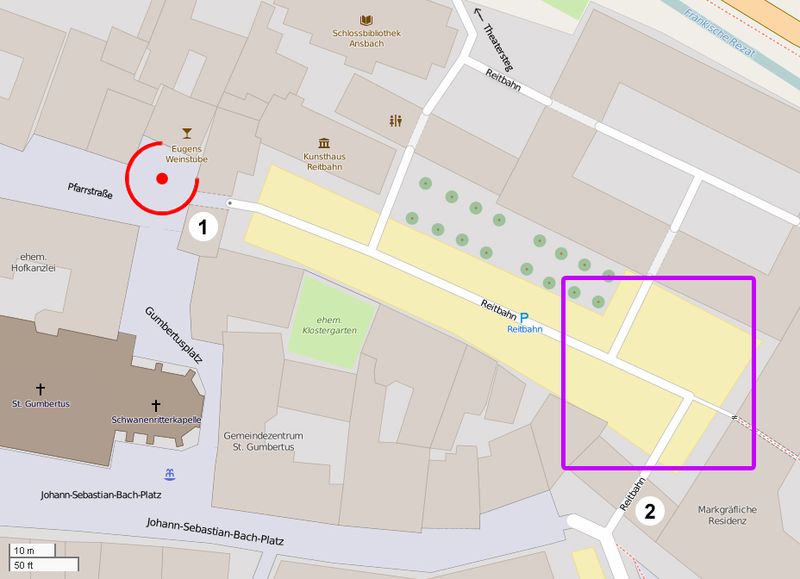
Die Karte zeigt, dass nur zwei tatsächlich nutzbare und sehr enge Ausgänge zur Verfügung standen. Bei einer Panik auf dem Veranstaltungsgelände wäre es daher sehr wahrscheinlich und allein schon deshalb zu Personenschäden gekommen.
English:
The map shows that only two effectively usable and very narrow exits were available. Therefore, in a panic scene of the event, it would be very probable and for this reason alone that personal injuries would have occurred.
Français :
La carte montre que seules deux sorties effectivement utilisables et très étroites étaient disponibles. Par conséquent, dans une scène de panique de l'événement, il serait très probable et pour cette seule raison que même des blessures personnelles auraient eu lieu.
|
| Date | |
| Source | openstreetmap.org |
| Author |
|
|
Permission
( Reusing this file ) |
All OpenStreetMap data and maps are Creative Commons "CC-BY-SA 2.0" licensed |
Licensing
This file is licensed under the
Creative Commons
Attribution-Share Alike 2.0 Generic
license.
-
You are free:
- to share – to copy, distribute and transmit the work
- to remix – to adapt the work
-
Under the following conditions:
- attribution – You must give appropriate credit, provide a link to the license, and indicate if changes were made. You may do so in any reasonable manner, but not in any way that suggests the licensor endorses you or your use.
- share alike – If you remix, transform, or build upon the material, you must distribute your contributions under the same or compatible license as the original.