SputnikSiteManitowocWI.jpg

Size of this preview:
800 × 499 pixels
.
Other resolutions:
320 × 200 pixels
|
640 × 399 pixels
|
1,024 × 638 pixels
|
1,280 × 798 pixels
|
2,560 × 1,596 pixels
|
3,902 × 2,433 pixels
.
Summary
| Description |
English:
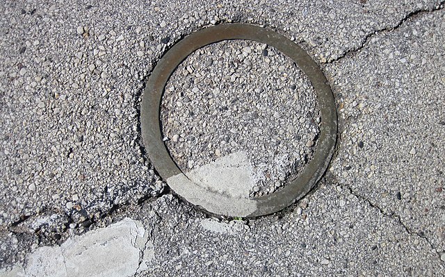
Round metal ring in the pavement of U.S. Highway 10 marking the landing place of Korabl-Sputnik 1 in Manitowoc, Wisconsin, United States
Español:
El círculo señala el lugar del impacto del Sputnik 4
日本語:
スプートニク4号の金属片が落下した路上にできた円形の跡
Polski:
Dysk oznaczający miejsce upadku satelity Korabl-Sputnik 1
Русский:
Отметка на месте падения спутника
|
||
| Date | |||
| Source | Own work | ||
| Author | Jonathunder | ||
|
Permission
( Reusing this file ) |
|
| Camera location |
|
View this and other nearby images on: OpenStreetMap |
|
|---|
Licensing

|
Permission is granted to copy, distribute and/or modify this document under the terms of the GNU Free Documentation License , Version 1.2 only as published by the Free Software Foundation ; with no Invariant Sections, no Front-Cover Texts, and no Back-Cover Texts. A copy of the license is included in the section entitled GNU Free Documentation License . | 1.2 only |