St._Mary's_Church,_Warrington_Road,_Lower_Ince_-_geograph.org.uk_-_78696.jpg
No higher resolution available.
Summary
| Description |
English:
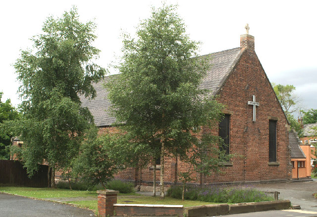
St. Mary's Church, Warrington Road, Lower Ince. The building was formerly part of the Hall of Ince Schools built between 1861 and 1875. The School moved to newer premises in 1974. The building was converted into the Church for the Parish in 1978, after it was decided to demolish the 1887 Paley & Austin church over the road which had become too expensive to repair, through mining subsidence damage.
|
| Date | |
| Source | From geograph.org.uk |
| Author | David Long |
|
Attribution
( required by the license ) |
David Long / St. Mary's Church, Warrington Road, Lower Ince / |
| Camera location |
|
View this and other nearby images on: OpenStreetMap |
|
|---|
_&language=en)
| Object location |
|
View this and other nearby images on: OpenStreetMap |
|
|---|
_&language=en)
Licensing

|
This image was taken from the
Geograph project
collection. See
this photograph's page
on the Geograph website for the photographer's contact details. The copyright on this image is owned by
David Long
and is licensed for reuse under the
Creative Commons
Attribution-ShareAlike 2.0 license.
|
This file is licensed under the
Creative Commons
Attribution-Share Alike 2.0 Generic
license.
Attribution:
David Long
-
You are free:
- to share – to copy, distribute and transmit the work
- to remix – to adapt the work
-
Under the following conditions:
- attribution – You must give appropriate credit, provide a link to the license, and indicate if changes were made. You may do so in any reasonable manner, but not in any way that suggests the licensor endorses you or your use.
- share alike – If you remix, transform, or build upon the material, you must distribute your contributions under the same or compatible license as the original.