St_Andrew,_Halton_Holegate_-_geograph.org.uk_-_451419.jpg
No higher resolution available.
Summary
| Description |
English:
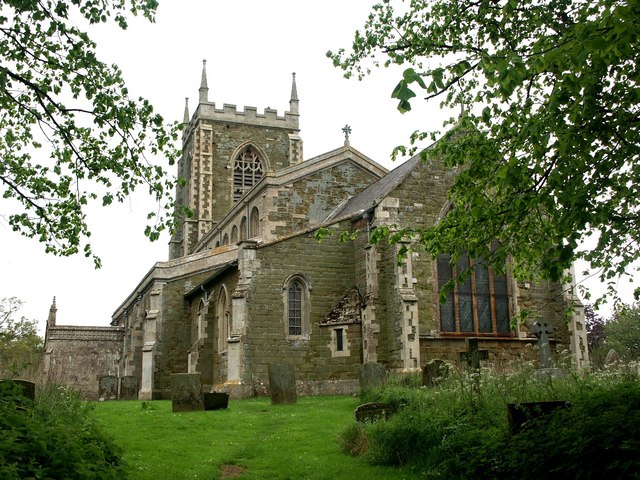
St Andrew, Halton Holegate The church dates from about 1400. In the late 19th century the chancel was restored with a stained glass window, carved pulpit and lectern, a new altar and the organ by Wordsworth of Leeds. At the east end of the south isle is a recumbent stone effigy of a knight, about 1350, and an ancient burial slab about 1250.
|
| Date | |
| Source | From geograph.org.uk |
| Author | Dave Hitchborne |
|
Attribution
( required by the license ) |
Dave Hitchborne / St Andrew, Halton Holegate / |
| Camera location |
|
View this and other nearby images on: OpenStreetMap |
|
|---|
_heading:315.00&language=en)
| Object location |
|
View this and other nearby images on: OpenStreetMap |
|
|---|
_heading:315.00&language=en)
Licensing

|
This image was taken from the
Geograph project
collection. See
this photograph's page
on the Geograph website for the photographer's contact details. The copyright on this image is owned by
Dave Hitchborne
and is licensed for reuse under the
Creative Commons
Attribution-ShareAlike 2.0 license.
|
This file is licensed under the
Creative Commons
Attribution-Share Alike 2.0 Generic
license.
Attribution:
Dave Hitchborne
-
You are free:
- to share – to copy, distribute and transmit the work
- to remix – to adapt the work
-
Under the following conditions:
- attribution – You must give appropriate credit, provide a link to the license, and indicate if changes were made. You may do so in any reasonable manner, but not in any way that suggests the licensor endorses you or your use.
- share alike – If you remix, transform, or build upon the material, you must distribute your contributions under the same or compatible license as the original.