St_Briavels_railway_station_(geograph_5419387).jpg
Size of this preview:
800 × 532 pixels
.
Other resolutions:
320 × 213 pixels
|
640 × 426 pixels
|
1,024 × 681 pixels
|
1,280 × 851 pixels
|
2,560 × 1,702 pixels
|
3,248 × 2,160 pixels
.
Summary
| Description |
English:
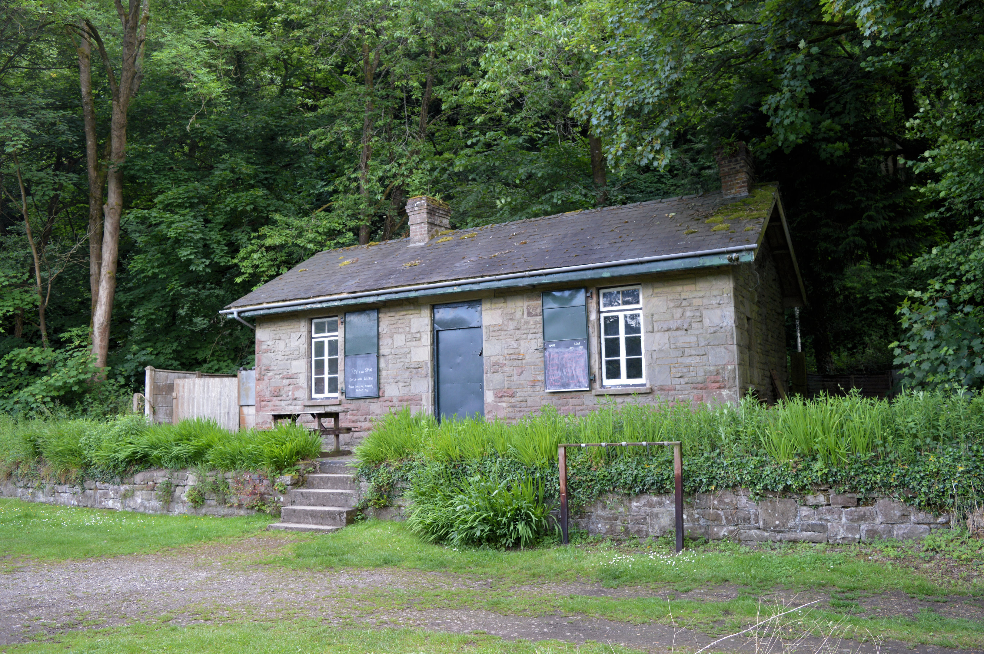
St Briavels railway station
The Wye Valley railway was opened on 1st November 1876 and ran from Tutshill (Chepstow) to Monmouth, a distance of almost 14 miles. The station at St Briavels was known as Bigsweir until 1909, and it closed to both passengers and goods traffic on 5th January 1959. A special 'last train' passed through on the following day, carrying more than 400 passengers. The locomotive on that day was pannier tank 6412, which like the station here has survived and can be seen on the South Devon Railway. The station now is the headquarters of a private fishing club. |
| Date | |
| Source | From geograph.org.uk |
| Author | Philip Pankhurst |
|
Permission
( Reusing this file ) |
Creative Commons Attribution Share-alike license 2.0 |
|
Attribution
( required by the license ) |
Philip Pankhurst / St Briavels railway station / |
| Camera location |
|
View this and other nearby images on: OpenStreetMap |
|
|---|
.jpg¶ms=051.741872_N_-002.671386_E_globe:Earth_type:camera_source:geograph-osgb36(SO53740501)_heading:270.00&language=en)
| Object location |
|
View this and other nearby images on: OpenStreetMap |
|
|---|
.jpg¶ms=051.741870_N_-002.671820_E_globe:Earth_class:object_type:object_source:geograph-osgb36(SO53710501)_heading:270.00&language=en)
Licensing

|
This image was taken from the
Geograph project
collection. See
this photograph's page
on the Geograph website for the photographer's contact details. The copyright on this image is owned by
Philip Pankhurst
and is licensed for reuse under the
Creative Commons
Attribution-ShareAlike 2.0 license.
|
This file is licensed under the
Creative Commons
Attribution-Share Alike 2.0 Generic
license.
Attribution:
Philip Pankhurst
-
You are free:
- to share – to copy, distribute and transmit the work
- to remix – to adapt the work
-
Under the following conditions:
- attribution – You must give appropriate credit, provide a link to the license, and indicate if changes were made. You may do so in any reasonable manner, but not in any way that suggests the licensor endorses you or your use.
- share alike – If you remix, transform, or build upon the material, you must distribute your contributions under the same or compatible license as the original.