St_Mary's_Church,_Dalkeith_Park_-_geograph.org.uk_-_1417491.jpg
No higher resolution available.
Summary
| Description |
English:
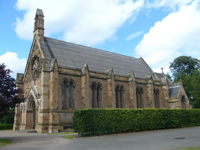
St Mary's Church, Dalkeith Park The church, built as a private chapel for the Duke of Buccleuch in 1845, made headlines in May 1913 when a bomb was discovered, presumed to have been planted by local militant suffragettes. A similar bomb exploded days later at Edinburgh's Blackford Hill Observatory. No arrests were made.
|
| Date | |
| Source | From geograph.org.uk |
| Author | kim traynor |
|
Attribution
( required by the license ) |
kim traynor / St Mary's Chapel, Dalkeith Park / |
| Camera location |
|
View this and other nearby images on: OpenStreetMap |
|
|---|
_heading:22.00&language=en)
| Object location |
|
View this and other nearby images on: OpenStreetMap |
|
|---|
_heading:22.00&language=en)
Licensing

|
This image was taken from the
Geograph project
collection. See
this photograph's page
on the Geograph website for the photographer's contact details. The copyright on this image is owned by
kim traynor
and is licensed for reuse under the
Creative Commons
Attribution-ShareAlike 2.0 license.
|
This file is licensed under the
Creative Commons
Attribution-Share Alike 2.0 Generic
license.
Attribution:
kim traynor
-
You are free:
- to share – to copy, distribute and transmit the work
- to remix – to adapt the work
-
Under the following conditions:
- attribution – You must give appropriate credit, provide a link to the license, and indicate if changes were made. You may do so in any reasonable manner, but not in any way that suggests the licensor endorses you or your use.
- share alike – If you remix, transform, or build upon the material, you must distribute your contributions under the same or compatible license as the original.