Stockport_Viaduct.jpg

Size of this preview:
800 × 600 pixels
.
Other resolutions:
320 × 240 pixels
|
640 × 480 pixels
|
1,000 × 750 pixels
.
Summary
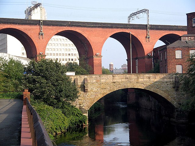
| Description | en:Stockport railway viaduct, carrying the en:West Coast Main Line over the Mersey valley. Photo by G-Man * Oct 2006 |
| Date | 9 November 2006 (original upload date) |
| Source | Transferred from en.wikipedia to Commons. |
| Author | G-Man at English Wikipedia |
| Camera location |
|
View this and other nearby images on: OpenStreetMap |
|
|---|
Licensing
|
|
This work has been released into the
public domain
by its author,
G-Man
at
English Wikipedia
. This applies worldwide.
In some countries this may not be legally possible; if so: G-Man grants anyone the right to use this work for any purpose , without any conditions, unless such conditions are required by law. |
Original upload log
The original description page was
here
. All following user names refer to en.wikipedia.
- 2006-11-09 20:42 G-Man 1000×750×8 (239338 bytes) [[Stockport]] railway viaduct, carrying the [[West Coast Main Line]] over the [[River Mersey|Mersey]] valley. Photo by ~~~ Oct 2006 {{PD-user|G-Man}}