Surtsey_eruption_1963.jpg

Size of this preview:
800 × 531 pixels
.
Other resolutions:
320 × 212 pixels
|
640 × 425 pixels
|
982 × 652 pixels
.
Summary
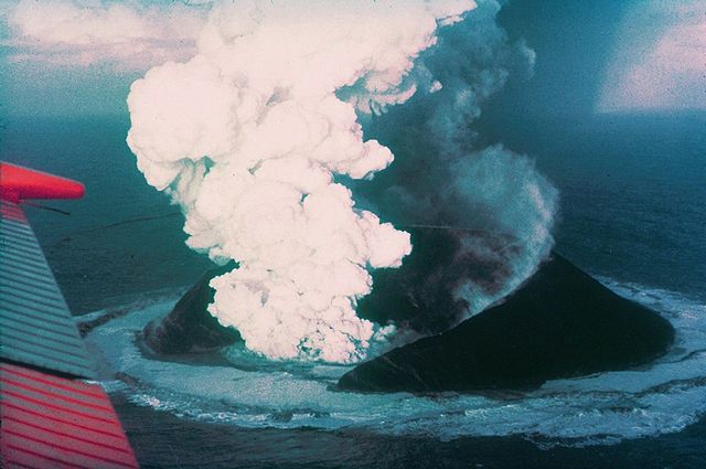
| Description | Surtsey on November 30, 1963, 16 days after the beginning of the eruption. |
| Date | |
| Source | http://www.ngdc.noaa.gov/seg/hazard/slideset/28/28_580_slide.shtml |
| Author | Howell Williams, NOAA |
| Object location |
|
View this and other nearby images on: OpenStreetMap |
|
|---|
Licensing
|
|
This image is in the
public domain
because it contains materials that originally came from the U.S.
National Oceanic and Atmospheric Administration
, taken or made as part of an employee's official duties.
|
|