Sverigekarta-Landsdelar_Götaland.svg

Size of this PNG preview of this SVG file:
263 × 599 pixels
.
Other resolutions:
105 × 240 pixels
|
211 × 480 pixels
|
337 × 768 pixels
|
450 × 1,024 pixels
|
900 × 2,048 pixels
|
290 × 660 pixels
.
| Description |
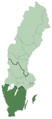
English:
Map of Sweden with the region
Götaland
marked.
Svenska:
Karta över Sverige med landsdelen
Götaland
markerad.
Deutsch:
Karte von Schweden mit dem hervorgehobenen Landesteil
Götaland
|
| Date | uploaded February 8, 2009 |
| Source | Based on Sverigekarta-Landskap.svg by Lapplänning which was based on SWE-Map Kommuner2007.svg by Lokal_Profil |
| Author | Lapplänning |
|
Permission
( Reusing this file ) |
This file is licensed under the
Creative Commons
Attribution-Share Alike 2.5 Generic
license.
|
| Other versions |
|


