Tabula_Rogeriana_1929_copy_by_Konrad_Miller.jpg

Size of this preview:
800 × 367 pixels
.
Other resolutions:
320 × 147 pixels
|
640 × 293 pixels
|
1,024 × 469 pixels
|
1,280 × 587 pixels
|
2,560 × 1,173 pixels
|
12,999 × 5,958 pixels
.
Summary
| Description |
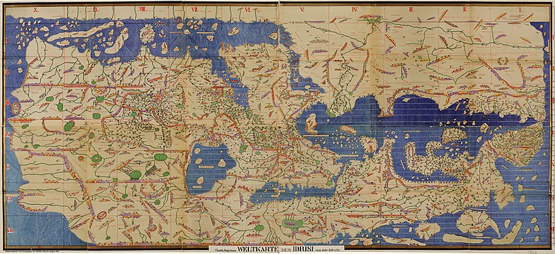
العربية:
نسخة لاتينيَّة مُنقحرة عن خريطة العالم للإدريسي. وضعها رسَّام الخرائط الألماني كونراد ميلر.
English:
Reconstitution of the map Tabula Rogeriana by arab geographer Al Idrisi, by German cartographer Konrad Miller. The arabic text is transcribed in the latin alphabet.
Français :
Reconstitution de la carte du géographe Al Idrissi, intitulée Tabula Rogeriana, par le cartographe allemand Konrad Miller. Le texte en arabe a été retranscrit en alphabet latin.
|
| Date | |
| Source | http://www.bigmapblog.com/2011/idrisis-tabula-rogeriana-world-map-reproduction/ |
| Author | Konrad Miller (1844-1933) |
| Other versions |
|

.jpg)


|
Licensing
|
This is a faithful photographic reproduction of a two-dimensional,
public domain
work of art. The work of art itself is in the public domain for the following reason:
The official position taken by the Wikimedia Foundation is that "
faithful reproductions of two-dimensional public domain works of art are public domain
".
This photographic reproduction is therefore also considered to be in the public domain in the United States. In other jurisdictions, re-use of this content may be restricted; see Reuse of PD-Art photographs for details. |
||||