Talcott_Mountain_Fall.jpg

Size of this preview:
800 × 266 pixels
.
Other resolutions:
320 × 106 pixels
|
640 × 212 pixels
|
1,919 × 637 pixels
.
Summary
| Description |
English:
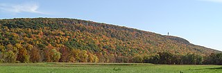
Own work. Taken from the
Farmington River
flood plain in
Simsbury
, 100 meters south of Route 185 on Nod Road.
|
| Date | 2 February 2010 (original upload date) |
| Source | Transferred from en.wikipedia |
| Author | Original uploader was Jehochman at en.wikipedia |
|
Permission
( Reusing this file ) |
CC-BY-SA-3.0-MIGRATED; Released under the GNU Free Documentation License . |
Licensing

|
Permission is granted to copy, distribute and/or modify this document under the terms of the GNU Free Documentation License , Version 1.2 or any later version published by the Free Software Foundation ; with no Invariant Sections, no Front-Cover Texts, and no Back-Cover Texts. A copy of the license is included in the section entitled GNU Free Documentation License . |
|
|
This file is licensed under the Creative Commons Attribution-Share Alike 3.0 Unported license. | |
|
||
| This licensing tag was added to this file as part of the GFDL licensing update . |
Original upload log
The original description page was
here
. All following user names refer to en.wikipedia.
- 2008-10-18 23:42 Jehochman 1919×637× (1347151 bytes) Reverted to version as of 22:34, 18 October 2008