Terrain_of_Norway_with_red_snow.jpg

Size of this preview:
436 × 599 pixels
.
Other resolutions:
175 × 240 pixels
|
349 × 480 pixels
|
559 × 768 pixels
|
745 × 1,024 pixels
|
2,091 × 2,873 pixels
.
Summary
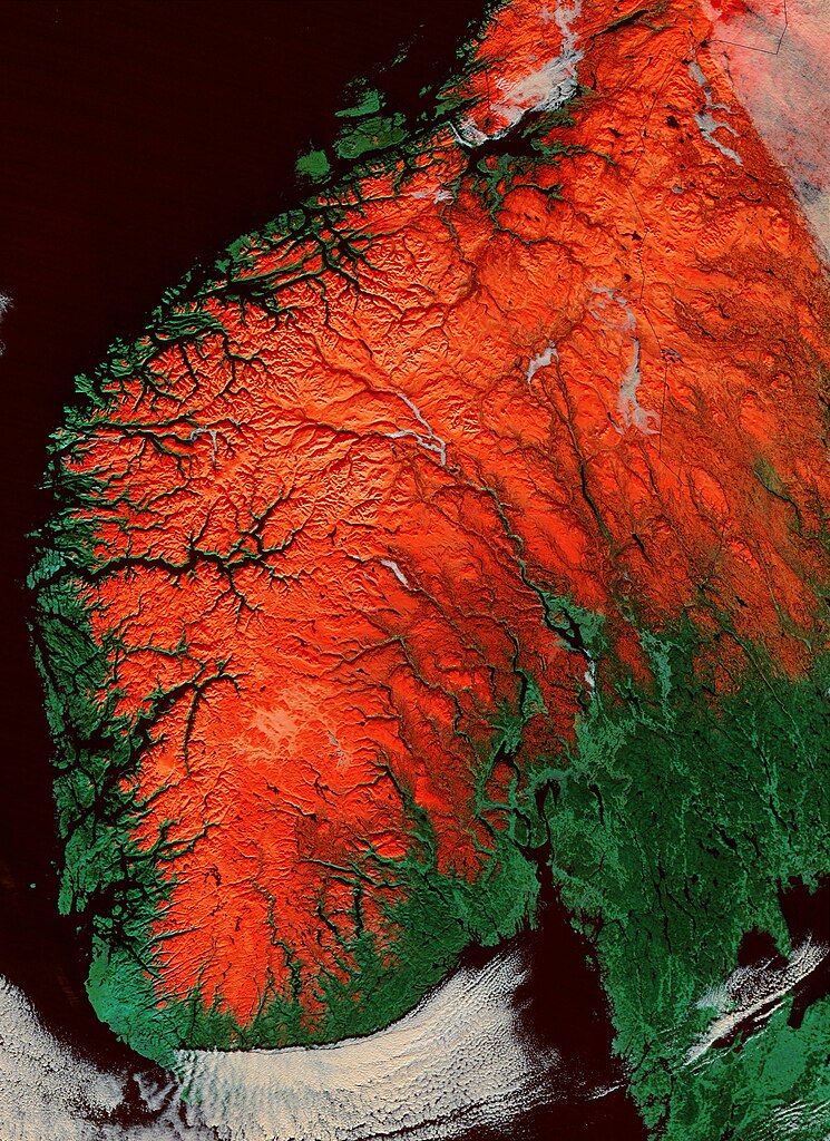
| Description | A satellite image of southern Norway with snow shown as red highlights the terrain. Especially the fjords Sognefjorden and Hardangerfjorden are clearly visible. |
| Date | |
| Source | http://visibleearth.nasa.gov/view_rec.php?id=4861 |
| Author | Jacques Descloitres, MODIS Rapid Response Team, NASA/GSFC |
| Other versions | Cropped, centering on Norways two largest fjords |
Licensing
|
|
This file is in the public domain in the United States because it was solely created by NASA . NASA copyright policy states that "NASA material is not protected by copyright unless noted ". (See Template:PD-USGov , NASA copyright policy page or JPL Image Use Policy .) |
|

|
Warnings:
|