The_Walkington_Hayride_-_geograph.org.uk_-_470593.jpg
No higher resolution available.
|
This is a photo of
listed building
number
1162565
.
|
Summary
| Description |
English:
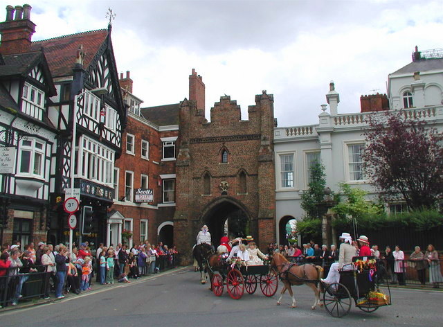
The Walkington Hayride,
Beverley
,
East Riding of Yorkshire
, England.
Participants in the Walkington Hayride pass through the North Bar gate on their way into Beverley town centre. The charity event was founded by Ernie Teal in 1967 but this is expected to be the last procession due to dwindling numbers of heavy horses and horsemen. North Bar (the brick arch in the centre of the picture) is the only one remaining of a number of gates which once guarded the entrances to Beverley. It was built by the town council in 1409 and cost a fraction over £96. |
| Date | |
| Source | From geograph.org.uk |
| Author | Paul Glazzard |
|
Permission
( Reusing this file ) |
Creative Commons Attribution Share-alike license 2.0 |
|
Attribution
( required by the license ) |
Paul Glazzard / The Walkington Hayride / |
| Camera location |
|
View this and other nearby images on: OpenStreetMap |
|
|---|
_heading:112.00&language=en)
| Object location |
|
View this and other nearby images on: OpenStreetMap |
|
|---|
_heading:112.00&language=en)
Licensing

|
This image was taken from the
Geograph project
collection. See
this photograph's page
on the Geograph website for the photographer's contact details. The copyright on this image is owned by
Paul Glazzard
and is licensed for reuse under the
Creative Commons
Attribution-ShareAlike 2.0 license.
|
This file is licensed under the
Creative Commons
Attribution-Share Alike 2.0 Generic
license.
Attribution:
Paul Glazzard
-
You are free:
- to share – to copy, distribute and transmit the work
- to remix – to adapt the work
-
Under the following conditions:
- attribution – You must give appropriate credit, provide a link to the license, and indicate if changes were made. You may do so in any reasonable manner, but not in any way that suggests the licensor endorses you or your use.
- share alike – If you remix, transform, or build upon the material, you must distribute your contributions under the same or compatible license as the original.