Third_Mari.png
Size of this preview:
778 × 599 pixels
.
Other resolutions:
312 × 240 pixels
|
623 × 480 pixels
|
997 × 768 pixels
|
1,324 × 1,020 pixels
.
Summary
| Description |
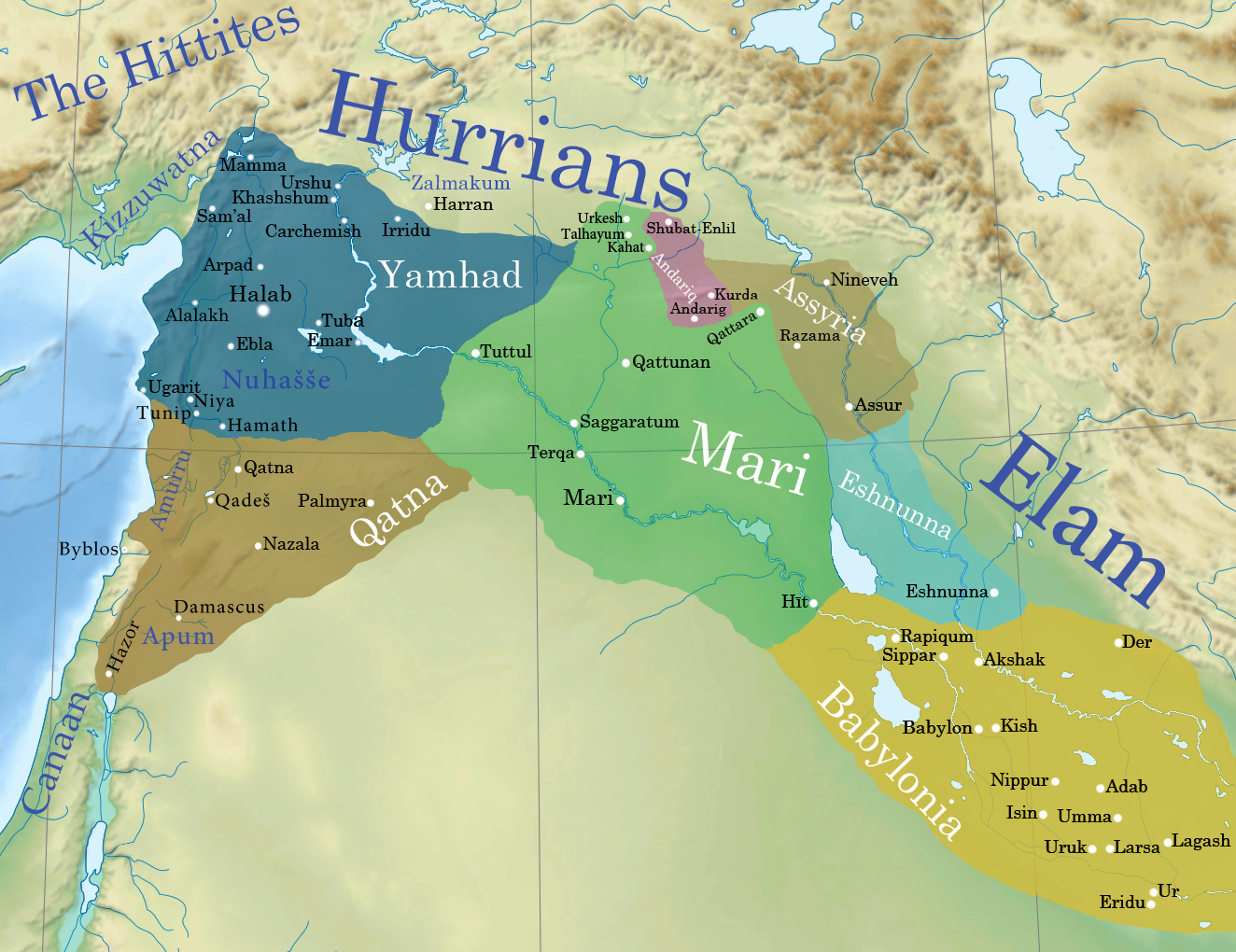
English:
Mari 1764 bc. In brown: Qatna at its height.
[1]
|
| Date | |
| Source | File:Near_East_topographic_map-blank.svg |
| Author | Attar-Aram syria |
|
|
This is a
retouched picture
, which means that it has been digitally altered from its original version. Modifications:
Yamhad in the levant
. The original can be viewed here:
Near East topographic map-blank.svg
:
|
Licensing
This file is licensed under the
Creative Commons
Attribution-Share Alike 4.0 International
license.
-
You are free:
- to share – to copy, distribute and transmit the work
- to remix – to adapt the work
-
Under the following conditions:
- attribution – You must give appropriate credit, provide a link to the license, and indicate if changes were made. You may do so in any reasonable manner, but not in any way that suggests the licensor endorses you or your use.
- share alike – If you remix, transform, or build upon the material, you must distribute your contributions under the same or compatible license as the original.
Original upload log
This image is a derivative work of the following images:
-
File:Near_East_topographic_map-blank.svg
licensed with Cc-by-sa-3.0,2.5,2.0,1.0, GFDL
- 2009-08-18T18:31:37Z Sémhur 2425x1581 (2442670 Bytes) 3 - New try
- 2009-08-17T15:39:22Z Sémhur 2425x1581 (1815374 Bytes) 2 - With the background...
- 2009-08-17T15:37:36Z Sémhur 2425x1581 (2836 Bytes) {{Information |Description={{en|1=Blank physical map of the [[:en:Near East|Near East]]}} {{fr|1=Carte physique vierge du [[:fr:Proche-Orient|Proche-Orient]].}} |Source={{own}} |Author=[[User:Sémhur|Sémhur]] |Date=2008-08-1
- ↑ Nele Ziegler (2007) Les Données des Archives Royales de Mari. Sur le Milieu Baturel et l'Occupation Humaine en Syrie Centrale , p. 77