Thurtal_mit_Seerücken-01.jpg
Size of this preview:
800 × 130 pixels
.
Other resolutions:
320 × 52 pixels
|
640 × 104 pixels
|
1,024 × 167 pixels
|
4,920 × 800 pixels
.
Summary
| Description |
Deutsch:
Thurtal mit dem Seerücken.
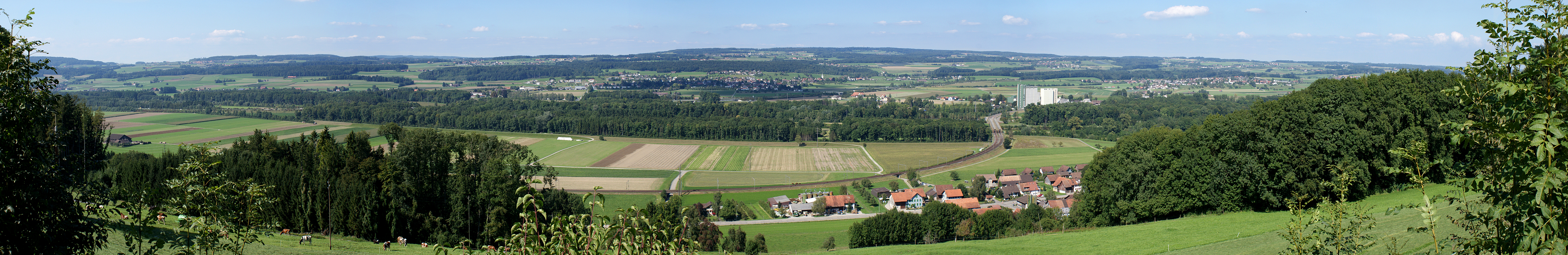
Der Versuch vom Seerücken so viel wie möglich auf einem Panorama abzubilden führte mich auf den Wellenberg. Auf der Fahrt von Harenwilen hinunter zum Dorf Hüttlingen bin ich am Geigenhof vorbeigekommen. Der Zwischenhalt scheint sich gelohnt zu haben. Im Blickfeld das Thurtal. Unten das Dorf Eschikofen, in der Bildmitte Müllheim und weiter oben am Seerücken das Dorf Homburg. EXIF Daten der ersten von 4 Querformataufnahmen: SONY DSLR-A300 27.08.2008 15:38:29 1/320 s - f/10 - ISO 200 - 35 mm / 52 mm Aufnahmestandort - Höhe / Koordinaten: 519 m - 717551 / 270688 (47° 34' 34.9“ N, 9° 0' 3.9“ E) (47.576361°, 9.001083°) Blickrichtung: 0° - Öffnungswinkel: ca. 120° |
| Date | |
| Source | Own work |
| Author | Walter45 |
| Camera location |
|
View this and other nearby images on: OpenStreetMap |
|
|---|
Licensing
I, the copyright holder of this work, hereby publish it under the following licenses:

|
Permission is granted to copy, distribute and/or modify this document under the terms of the GNU Free Documentation License , Version 1.2 or any later version published by the Free Software Foundation ; with no Invariant Sections, no Front-Cover Texts, and no Back-Cover Texts. A copy of the license is included in the section entitled GNU Free Documentation License . |
This file is licensed under the
Creative Commons
Attribution-Share Alike 3.0 Unported
license.
-
You are free:
- to share – to copy, distribute and transmit the work
- to remix – to adapt the work
-
Under the following conditions:
- attribution – You must give appropriate credit, provide a link to the license, and indicate if changes were made. You may do so in any reasonable manner, but not in any way that suggests the licensor endorses you or your use.
- share alike – If you remix, transform, or build upon the material, you must distribute your contributions under the same or compatible license as the original.
You may select the license of your choice.