Tlaxcalamap.jpg
Summary
| Description |
English:
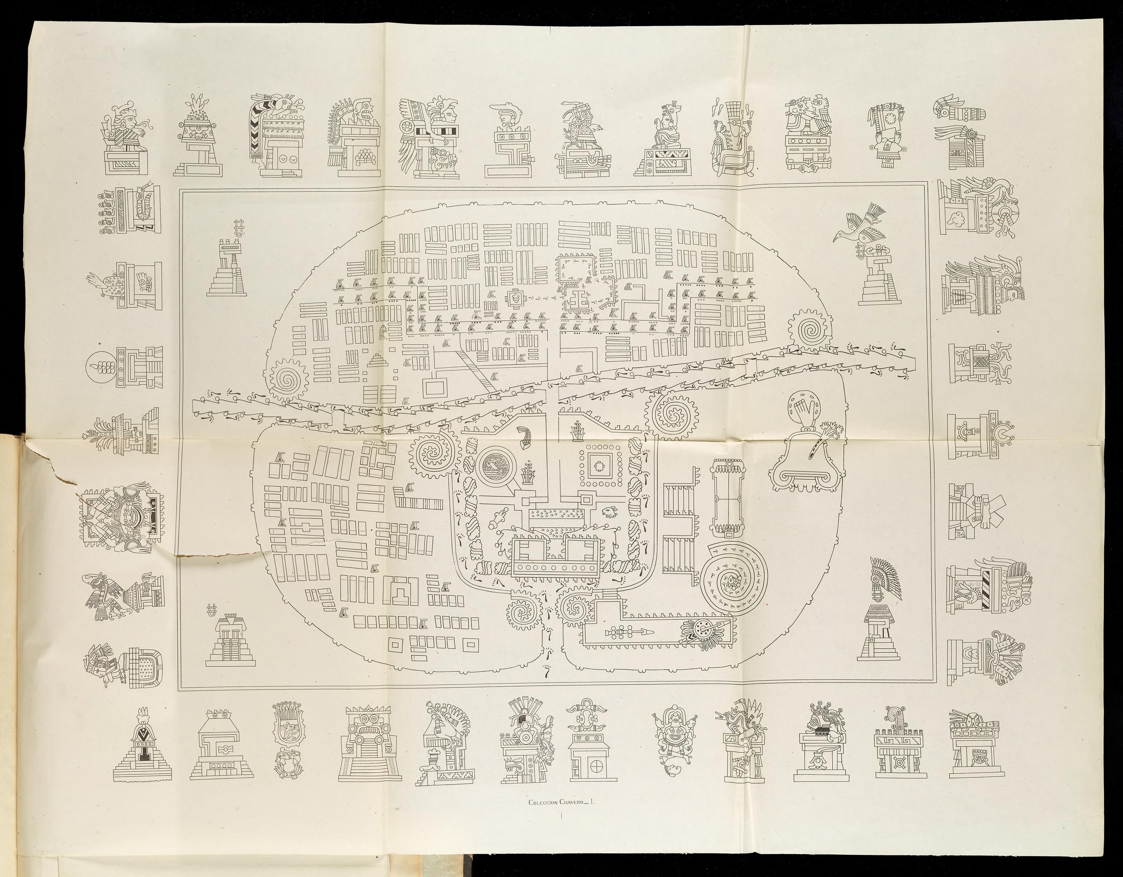
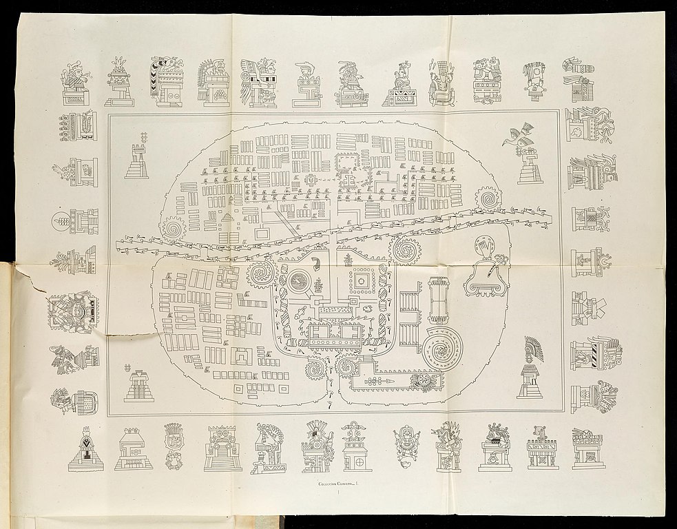
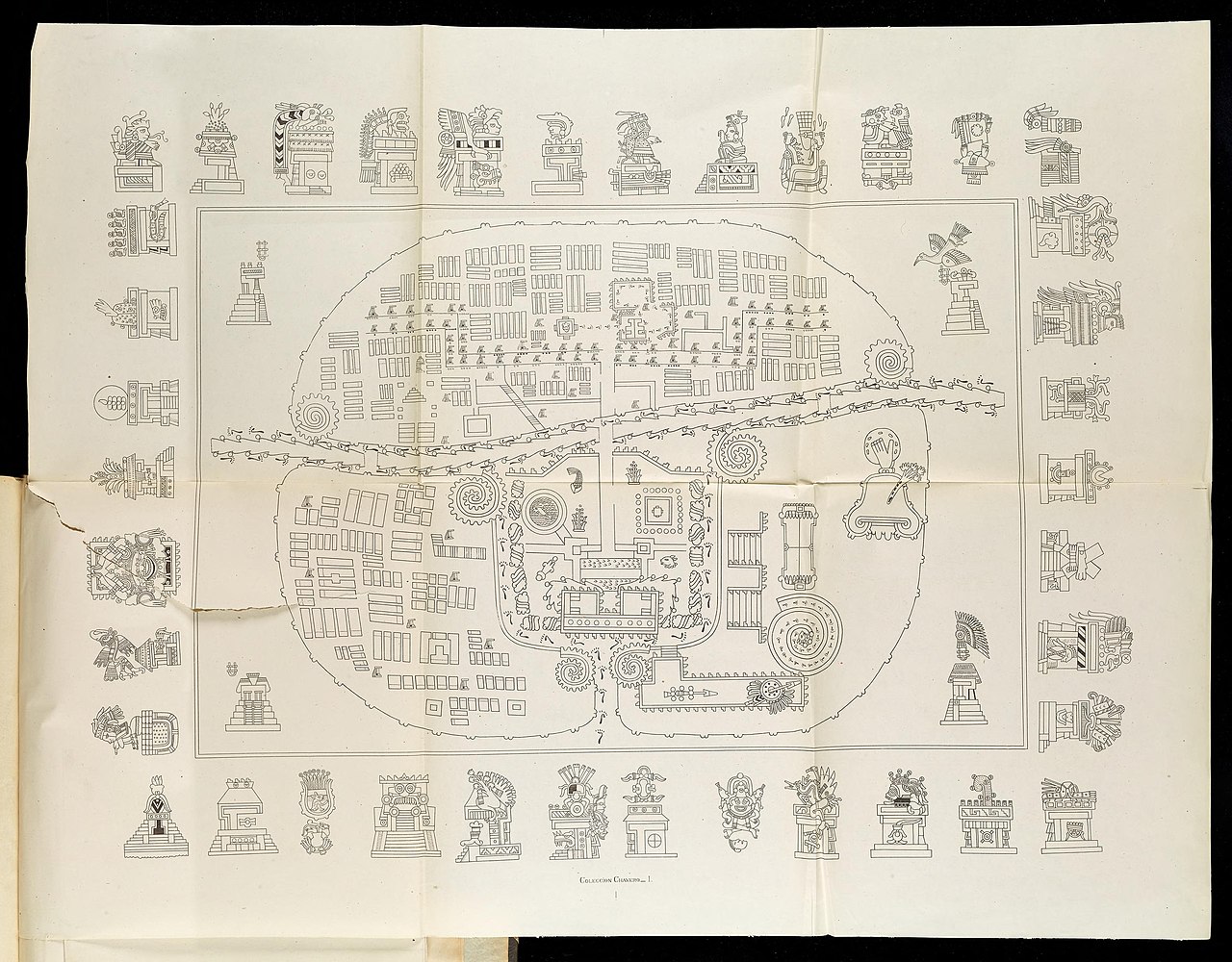
A Map of Tlaxcala: The top-right hand sector is Tizatlan, the bottom-right hand sector Quiahuiztlan, the top-left hand sector Ocotelolco, and the bottom-left hand sector Tepeticpac. The river, Atzompa, crosses the city from North to South (left to right, the map being oriented along an East-West axis).
Italiano:
Mappa di Tlaxcala.Il settore in alto a destra è Tizatlan, quello in basso a destra è Quiahuiztlan, quello in alto a sinistra è Ocotelolco e quello in basso a sinistra è Tepeticpac. Il fiume, Atzompa, attraversa la città da nord a sud (da sinistra a destra, dato che la mappa è orientata sull'asse est-ovest). Tratta da Alfredo Chavero, Pintures Jeroglificas, Messico, 1901.
|
| Date | |
| Source | Pinturas Jeroglíficas, Mexico: https://archive.org/details/gri_33125009867314 |
| Author | Alfredo Chavero |
Licensing
|
|
This work is in the public domain in its country of origin and other countries and areas where the copyright term is the author's life plus 70 years or fewer .
|
| This file has been identified as being free of known restrictions under copyright law, including all related and neighboring rights. | |
Original upload log
- 2009-07-06 03:43 Robert M Johnson 871×663× (693169 bytes) == Description == {{Information |Description= Map of the [[Nahuatl]] city [[Tlaxcala]] from the 20th century, |Source=Originally from [http://books.google.com/books?id=o-sMQAovYJoC&pg=PA461&lpg=PA461&dq=Tepeticpac+tlaxcala&source=bl&ots=1y1yM9xzIM&sig=u6