Trigonometrical_Plan_of_the_Island_and_Harbour_of_Bahrain.jpg
Size of this preview:
529 × 599 pixels
.
Other resolutions:
212 × 240 pixels
|
424 × 480 pixels
|
678 × 768 pixels
|
904 × 1,024 pixels
|
2,098 × 2,376 pixels
.
Summary
| Description |
English:
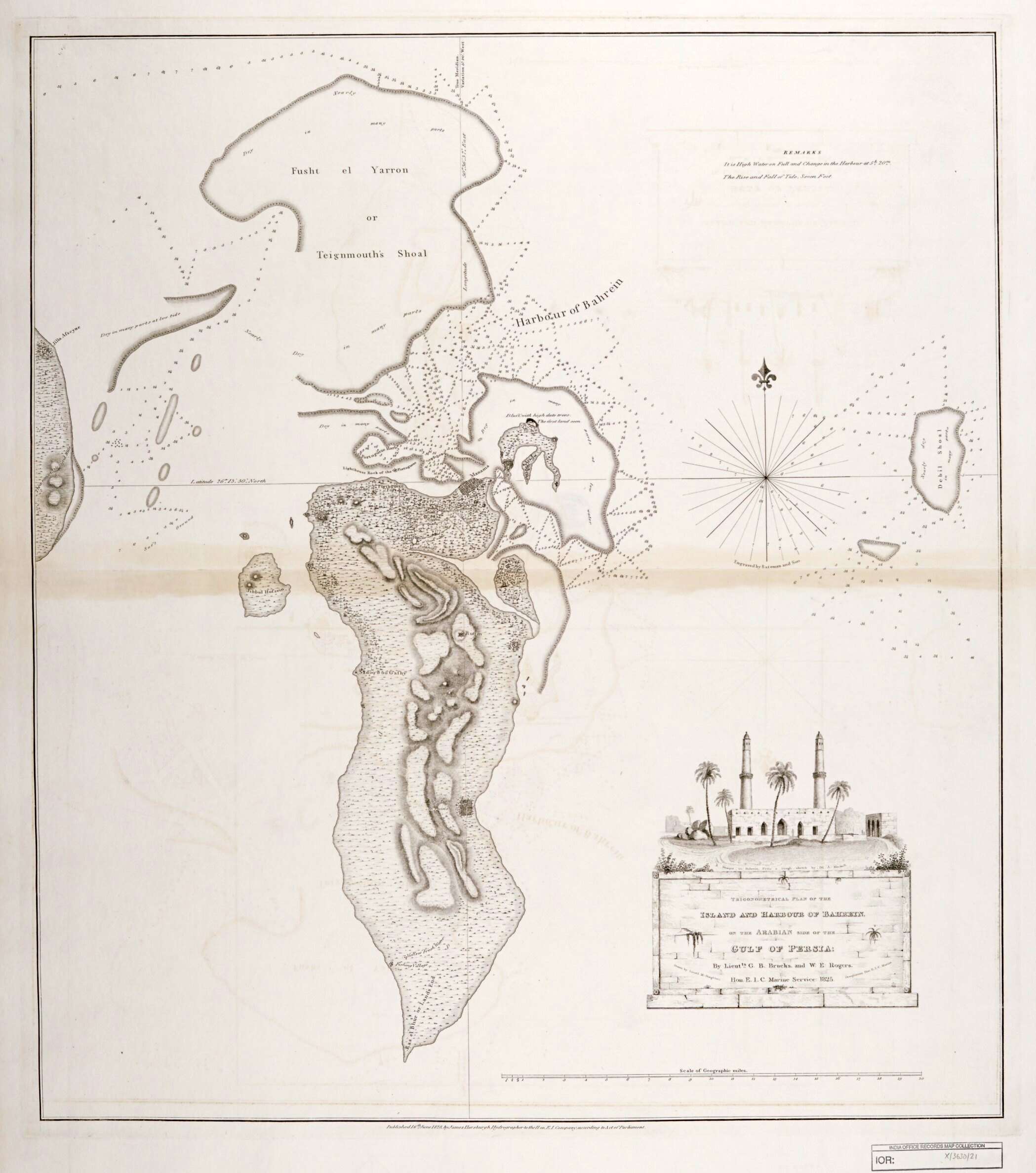
"‘Trigonometrical Plan of the Island and Harbour of Bahrein, on the Arabian Side of the Gulf of Persia; by Lieutts. G.B. Brucks, and W.E. Rogers. Hon. E.I.C. Marine Service: 1825. Drawn by Lieutt. M. Houghton; Draughtsman Hon. E.I.C. Marine. Engraved by Bateman and Son’"
|
| Date | |
| Source | Qatar Digital Library |
| Author | by Lieutts. G.B. Brucks, and W.E. Rogers. Hon. E.I.C. Marine Service: 1825. Drawn by Lieutt. M. Houghton; Draughtsman Hon. E.I.C. Marine |
| Other versions |

Licensing
.svg)
|
This file is licensed under the
Open Government Licence version 1.0
(
OGL v1.0
).
|
|---|---|
| Attribution: 1 | |
|
You are free to:
See the Open Government Licence page on Meta-Wiki for more information.
|