Trinidad_and_Tobago_OnEarth_WMS.png

Size of this preview:
644 × 600 pixels
.
Other resolutions:
258 × 240 pixels
|
515 × 480 pixels
|
825 × 768 pixels
|
1,099 × 1,024 pixels
|
2,058 × 1,917 pixels
.
Summary
| Description |
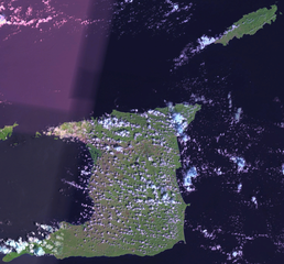
English:
Satellite image of Trinidad and Tobago.
|
| Date | 1 May 2006 (upload date) |
| Source | Satellite imagery taken from NASA World Wind software (by screenshot). OnEarth WMS global mosaic pseudocolor layer. |
| Author | NASA |
Licensing
|
|
This image is in the
public domain
because it is a screenshot from
NASA
’s globe software
World Wind
using a public domain layer, such as Blue Marble, MODIS, Landsat, SRTM, USGS or GLOBE.
|

|