Typhoon_Ketsana_2003.jpg
Size of this preview:
492 × 600 pixels
.
Other resolutions:
197 × 240 pixels
|
394 × 480 pixels
|
630 × 768 pixels
|
840 × 1,024 pixels
|
1,680 × 2,048 pixels
|
6,400 × 7,800 pixels
.
Summary
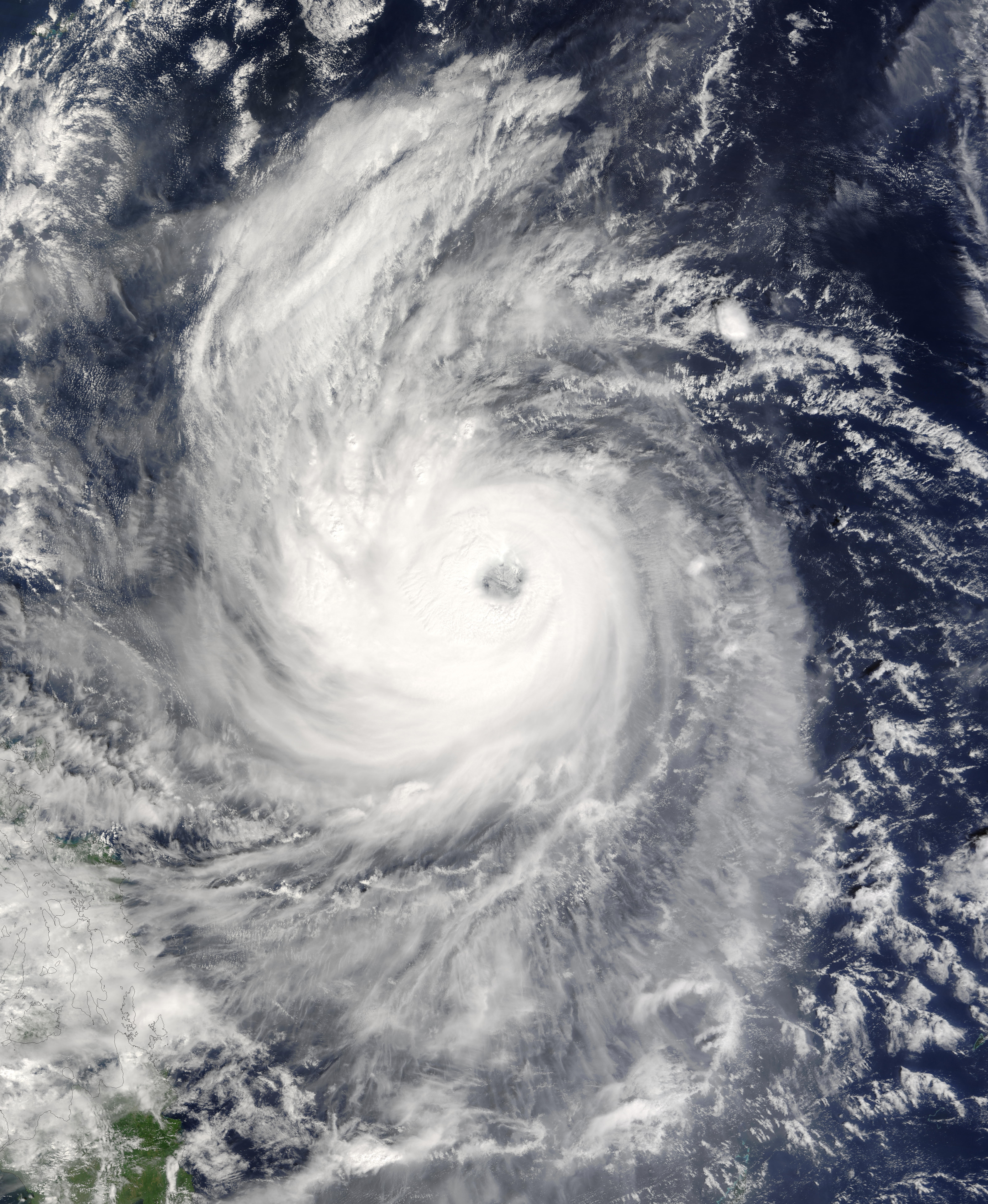
| Description | Typhoon Ketsana spins north, northeast away from the Philippine Islands in this Moderate Resolution Imaging Spectroradiometer (MODIS) image captured by the Terra satellite on October 21, 2003, at 1:55 UTC. At the time this image was taken, the storm had sustained winds of 144 miles per hour with gusts to 173 miles per hour, the equivalent of a Category 4 hurricane on the Saffir-Simpson Hurricane Scale. | |||||
| Date | ||||||
| Source | http://visibleearth.nasa.gov/view_rec.php?id=5952 | |||||
| Author | Jeff Schmaltz, MODIS Rapid Response Team, NASA/GSFC | |||||
|
Permission
( Reusing this file ) |
|
