UKWMO_Wartime_Headquarters_-_geograph.org.uk_-_189601.jpg
No higher resolution available.
Summary
| Description |
English:
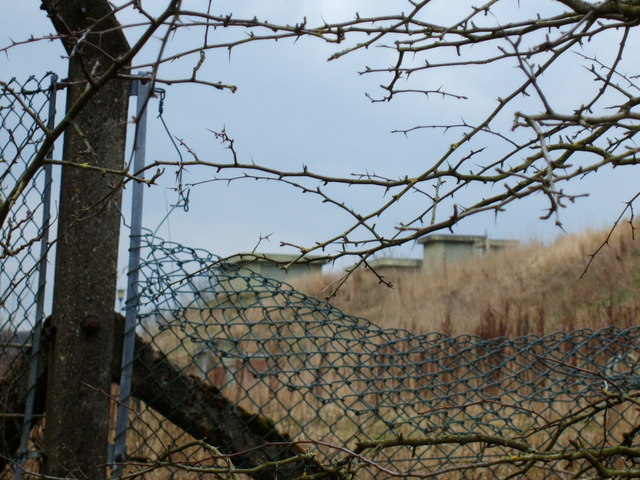
UKWMO Wartime Headquarters. The United Kingdom Warning and Monitoring Organization (UKWMO) was the successor to the Royal Observer Corps in the warning of the public and also the Government and Military, of a nuclear attack against the UK. This bunker in Goosenargh is where the infamous "Attack Warning Red" would have been broadcast from, after the Ballistic Missile Early Warning System (BMEWS) on Fylingdales Moor picked up the inbound missiles. Another relic of man's most dangerous time on earth and Cold War relic left to rot away.
|
| Date | |
| Source | From geograph.org.uk |
| Author | Saul Beeson |
|
Attribution
( required by the license ) |
Saul Beeson / UKWMO Wartime Headquarters / |
| Object location |
|
View this and other nearby images on: OpenStreetMap |
|
|---|
_heading:270.00&language=en)
Licensing

|
This image was taken from the
Geograph project
collection. See
this photograph's page
on the Geograph website for the photographer's contact details. The copyright on this image is owned by
Saul Beeson
and is licensed for reuse under the
Creative Commons
Attribution-ShareAlike 2.0 license.
|
This file is licensed under the
Creative Commons
Attribution-Share Alike 2.0 Generic
license.
Attribution:
Saul Beeson
-
You are free:
- to share – to copy, distribute and transmit the work
- to remix – to adapt the work
-
Under the following conditions:
- attribution – You must give appropriate credit, provide a link to the license, and indicate if changes were made. You may do so in any reasonable manner, but not in any way that suggests the licensor endorses you or your use.
- share alike – If you remix, transform, or build upon the material, you must distribute your contributions under the same or compatible license as the original.
- Remove redundant categories and try to put this image in the most specific category/categories
- Remove this template
- The location categories are based on information from this geonames tool and this OpenStreetMap tool combined with a database. You can also have a look at this tool from mysociety .
- The topic category from Geograph was Cold War relic (find similar images War relic at Geograph )