USACE_Lucky_Peak_Dam_Idaho.jpg

Size of this preview:
800 × 527 pixels
.
Other resolutions:
320 × 211 pixels
|
640 × 422 pixels
|
1,024 × 675 pixels
|
1,500 × 989 pixels
.
| Description |
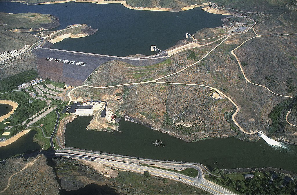
English:
Lucky Peak Dam on the Boise River, about 10 miles southeast of Boise, Idaho, USA.
|
|||
| Location |
Boise, Idaho, USA
43°31′41.7″N 116°3′13.91″W / 43.52825°N 116.0538639°W |
|||
| Date | ||||
| Source |
U.S. Army Corp of Engineers Digital Visual Library
Digital Visual Library home page Image page Image description page |
|||
| Author | Bob Heims, U.S. Army Corps of Engineers | |||
|
Permission
( Reusing this file ) |
|