USACE_Navarro_Mills_Lake_and_Dam.jpg
Size of this preview:
800 × 533 pixels
.
Other resolutions:
320 × 213 pixels
|
640 × 427 pixels
|
1,024 × 683 pixels
|
1,500 × 1,000 pixels
.
| Description |
English:
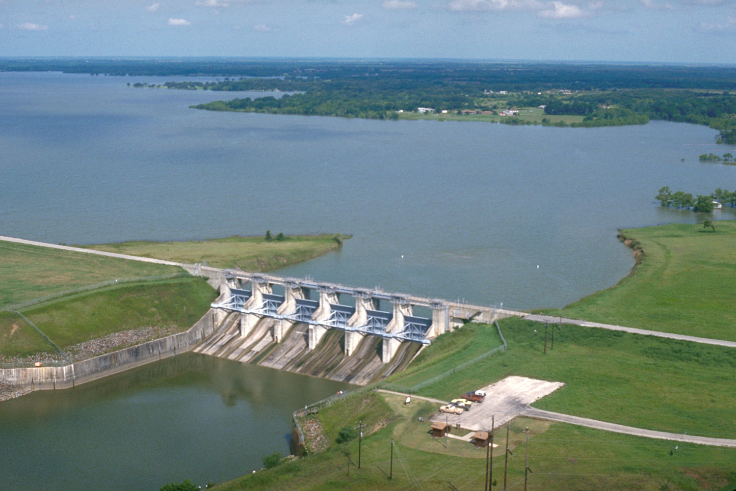
Aerial view of Navarro Mills Lake and Dam on Richland Creek in Navarro County, Texas, USA. The U.S. Army Corps of Engineers constructed this dam in 1963 for flood control and water supply for Navarro County. This concrete and earth-fill dam is about three-quarters of a mile (1 km) long, but this photograph shows only the central water-control structure of the dam. View is to the northwest.
Coordinates:
31°57′27.18″N
96°41′22.1″W
/
31.95755°N 96.689472°W
|
|||
| Location | Navarro County, Texas, USA | |||
| Date | ( Caveat: Dates provided by U.S. Army Corps of Engineers Digital Visual Library are not reliable and may be wrong.) | |||
| Source |
U.S. Army Corps of Engineers Digital Visual Library
Image page Image description page Digital Visual Library home page |
|||
| Author | U.S. Army Corps of Engineers, photographer not specified or unknown | |||
|
Permission
( Reusing this file ) |
|