USACE_Webbers_Falls_Lock_and_Dam.jpg
Size of this preview:
400 × 599 pixels
.
Other resolutions:
160 × 240 pixels
|
320 × 480 pixels
|
1,001 × 1,500 pixels
.
| Description |
English:
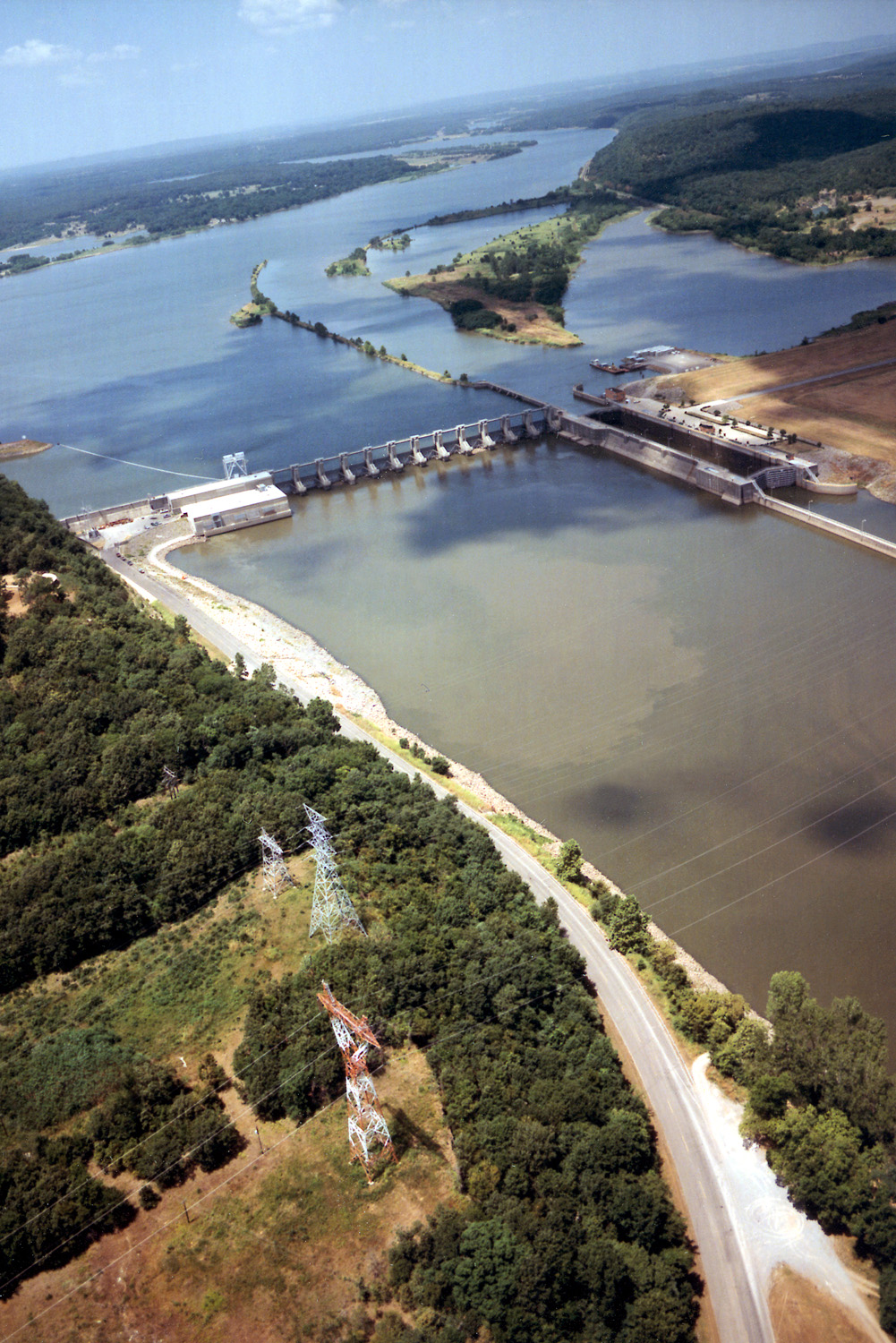
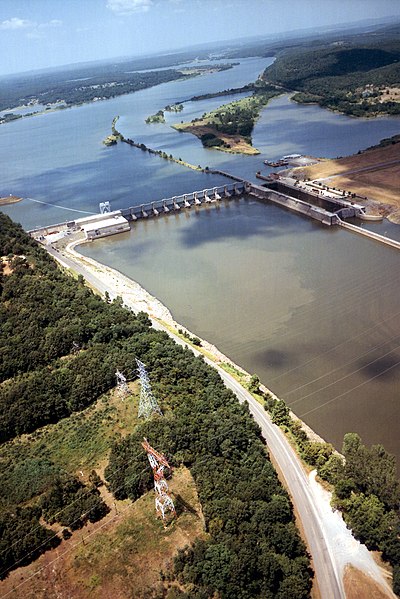
Aerial view of Webbers Falls Lock and Dam on the Arkansas River in Muskogee County, Oklahoma, USA. The dam is located about 4 miles (6.4 km) upriver from the town of Webbers Falls and about 62 miles (100 km) (straight line) southeast of Tulsa. The U.S. Army Corps of Engineers maintains the locks and the river channel for barge navigation on the river. View is upriver to the northwest.
Coordinates:
35°33′13.73″N
95°10′9.26″W
/
35.5538139°N 95.1692389°W
|
|||
| Location | Muskogee County, Oklahoma, USA | |||
| Date | ( Caveat: Dates provided by U.S. Army Corps of Engineers Digital Visual Library are not reliable and may be wrong.) | |||
| Source |
U.S. Army Corps of Engineers Digital Visual Library
Image page Image description page Digital Visual Library home page |
|||
| Author | U.S. Army Corps of Engineers, photographer not specified or unknown | |||
|
Permission
( Reusing this file ) |
|