US_federal_land.agencies.svg

Size of this PNG preview of this SVG file:
776 × 600 pixels
.
Other resolutions:
311 × 240 pixels
|
621 × 480 pixels
|
994 × 768 pixels
|
1,280 × 989 pixels
|
2,560 × 1,978 pixels
|
990 × 765 pixels
.
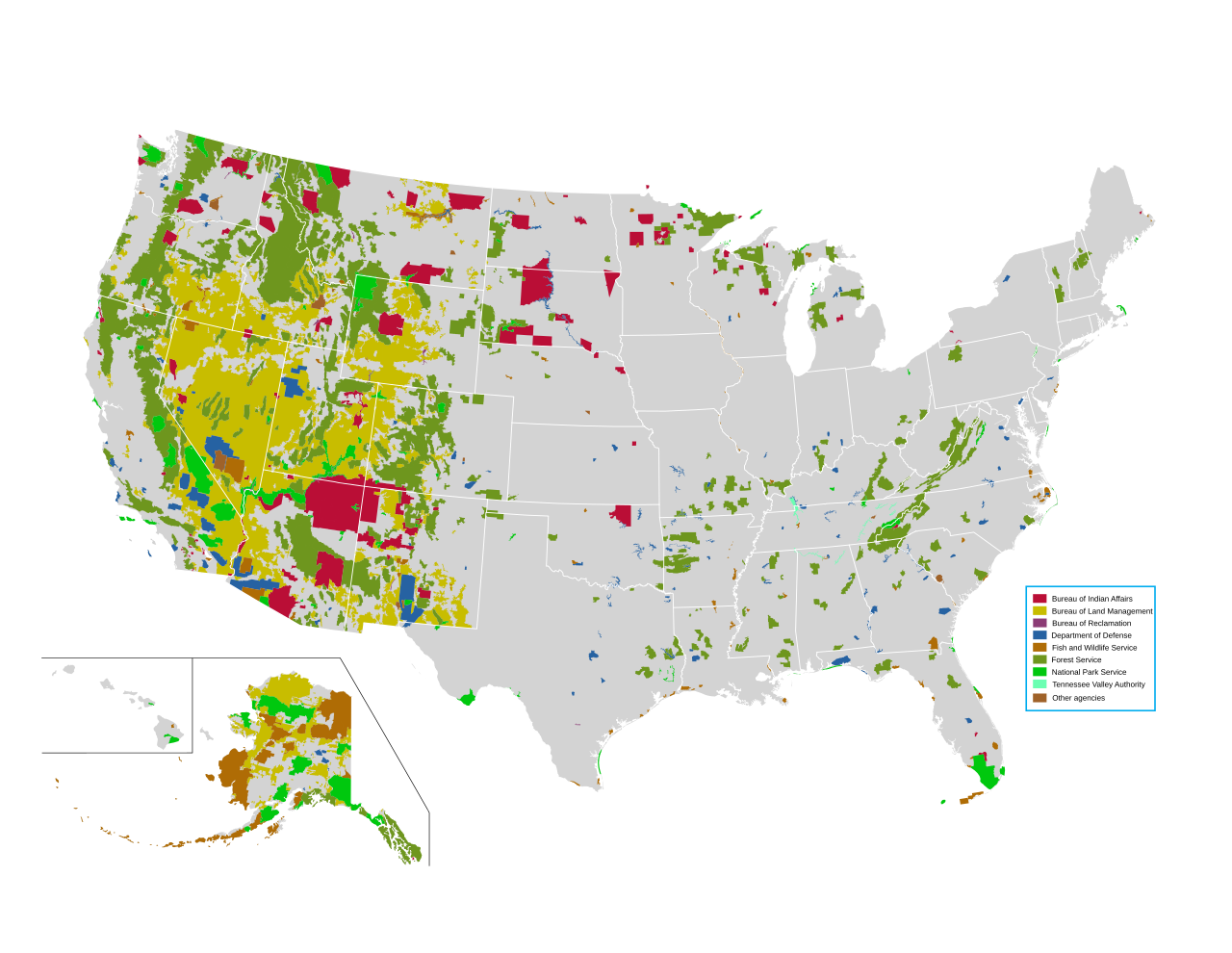
Department of Defense
(includes
Army Corps of Engineers
projects)
Other agencies
Summary
| Description |
English:
Map of all federally owned land in the United States.
|
| Source | http://nationalatlas.gov/printable/fedlands.html , " All Federal and Indian Lands " |
| Author | National Atlas of the United States |
Licensing
|
|
This map was obtained from an edition of the
National Atlas of the United States
. Like almost all works of the U.S. federal government, works from the
National Atlas
are in the
public domain
in the United States.
Online access: NationalAtlas.gov | 1970 print edition: Library of Congress , Perry-Castañeda Library
|
|