United_Kingdom_overseas_military_installations_and_operations.png
Size of this preview:
800 × 351 pixels
.
Other resolutions:
320 × 140 pixels
|
640 × 281 pixels
|
1,425 × 625 pixels
.
Summary
| Description |
English:
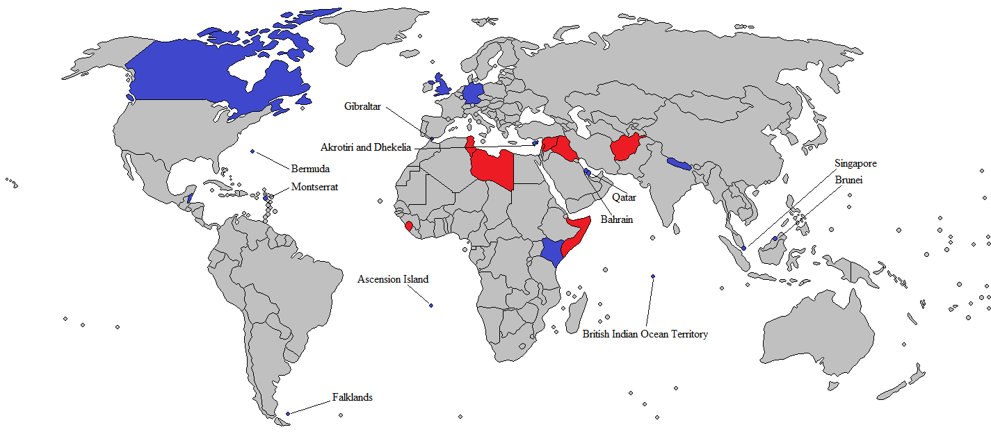
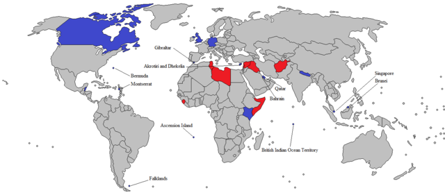
A map showing all United Kingdom overseas military installations (Blue) and locally raised units of her overseas territories (blue). Also shows all military interventions undertook since the year 2000 (red).
|
||
| Date | |||
| Source | Own work | ||
| Author | Antiochus the Great | ||
| Other versions |
|

Licensing
I, the copyright holder of this work, hereby publish it under the following license:
This file is licensed under the
Creative Commons
Attribution-Share Alike 4.0 International
license.
-
You are free:
- to share – to copy, distribute and transmit the work
- to remix – to adapt the work
-
Under the following conditions:
- attribution – You must give appropriate credit, provide a link to the license, and indicate if changes were made. You may do so in any reasonable manner, but not in any way that suggests the licensor endorses you or your use.
- share alike – If you remix, transform, or build upon the material, you must distribute your contributions under the same or compatible license as the original.