United_States_System_of_Highways_Adopted_for_Uniform_Marking_by_the_American_Association_of_State_Highway_Officials.jpg

Size of this preview:
800 × 522 pixels
.
Other resolutions:
320 × 209 pixels
|
640 × 417 pixels
|
1,024 × 668 pixels
|
1,280 × 835 pixels
|
2,560 × 1,669 pixels
|
8,972 × 5,851 pixels
.
| Description |
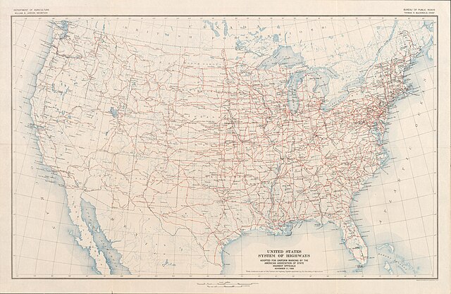
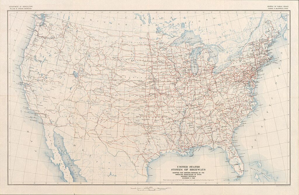
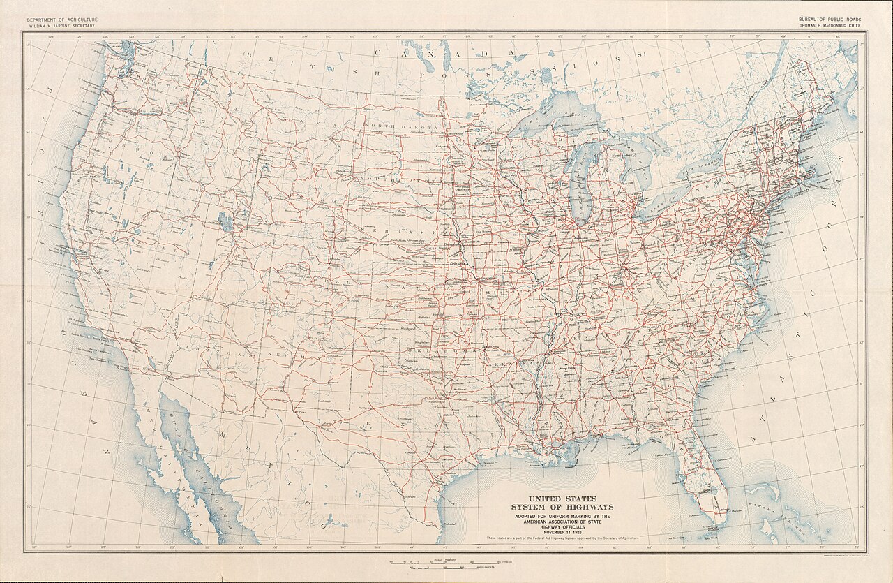
English:
Map of the final U.S. Highway system as approved November 11, 1926
Français :
Carte du système final US Highway comme approuvé en 11 Novembre 1926
日本語:
最終的な米ハイウェイシステムの地図は、1926年11月11日承認されました
|
||||
| Date | |||||
| Source | Bureau of Public Roads & American Association of State Highway Officials (November 11, 1926). United States System of Highways Adopted for Uniform Marking by the American Association of State Highway Officials (Map). 1:7,000,000. Washington, DC: United States Geological Survey . OCLC 32889555 . Retrieved November 7, 2013 – via University of North Texas Libraries. | ||||
| Author |
|
||||
|
Permission
( Reusing this file ) |
|

