UpperDiamantinaCrustalAnomaly.png
Size of this preview:
800 × 497 pixels
.
Other resolutions:
320 × 199 pixels
|
640 × 398 pixels
|
858 × 533 pixels
.
Summary
| Description |
English:
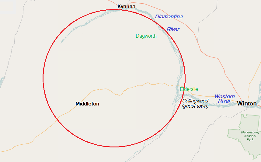
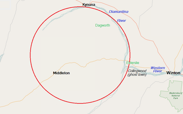
Map of the region west of
Winton, Queensland
, Australia, in the headwaters of the
Diamantina River
, that is the subject of geological interest as a possible 300,000,000-year-old impact structure; places marked in green are pastoral stations.
|
| Date | |
| Source | OpenStreetMap Foundation |
| Author | © OpenStreetMap contributors, with uploader's modifications |
Licensing
This file is licensed under the
Creative Commons
Attribution-Share Alike 4.0 International
license.
-
You are free:
- to share – to copy, distribute and transmit the work
- to remix – to adapt the work
-
Under the following conditions:
- attribution – You must give appropriate credit, provide a link to the license, and indicate if changes were made. You may do so in any reasonable manner, but not in any way that suggests the licensor endorses you or your use.
- share alike – If you remix, transform, or build upon the material, you must distribute your contributions under the same or compatible license as the original.