VLFatPalmer.JPG

Size of this preview:
800 × 600 pixels
.
Other resolutions:
320 × 240 pixels
|
640 × 480 pixels
|
856 × 642 pixels
.
Summary
| Description |
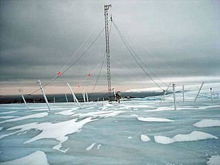
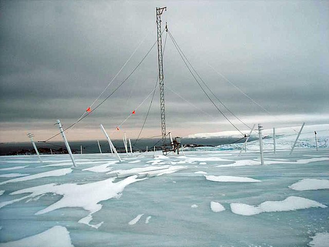
Français :
antenne parapluie VLF (
Très Basse Fréquence 28,5 kHz
) de la station Palmer est situé sur l'île d'Anvers, près de l'extrémité de la péninsule Antarctique, Base antarctique Palmer à 64°46′27″S 64°03′11″O.
English:
A VLF receiving antenna at Palmer Station, Antarctica, operated by Stanford University
|
| Date | |
| Source | http://en.wikipedia.org/wiki/File:VLFatPalmer.JPG |
| Author | F1jmm - http://en.wikipedia.org/wiki/User:Heinz_it_up_ |
| Object location |
|
View this and other nearby images on: OpenStreetMap |
|
|---|
Licensing
|
|
I, the copyright holder of this work, release this work into the
public domain
. This applies worldwide.
In some countries this may not be legally possible; if so: I grant anyone the right to use this work for any purpose , without any conditions, unless such conditions are required by law. |
Original upload log
The original description page is/was here . All following user names refer to en.wikipedia.
- 08:32, May 22, 2007 Heinz it up 57 (86 bytes) (A VLF receiving antenna at Palmer Station, Antarctica, operated by Stanford University)