Verbreitungsgebiet_der_heutigen_niederdeutschen_Mundarten-2.PNG
Size of this preview:
600 × 600 pixels
.
Other resolutions:
240 × 240 pixels
|
480 × 480 pixels
|
768 × 768 pixels
|
1,024 × 1,024 pixels
|
1,304 × 1,304 pixels
.
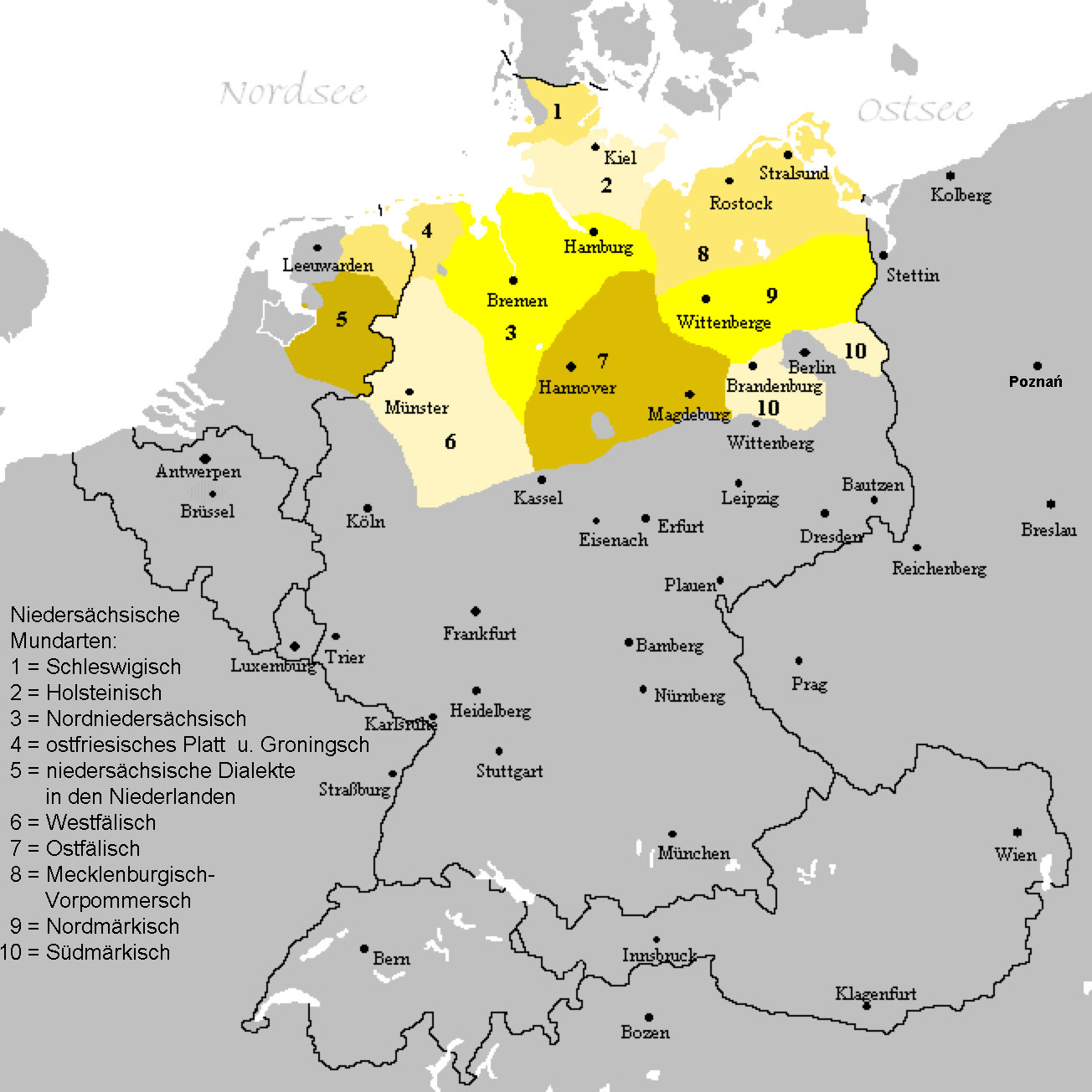
| Description | A map of Low German language with Low Franconian dialects excluded. The map shows the area of all Low Saxon dialects. |
| Date | (UTC) |
| Source | |
| Author |
|
|
|
This is a
retouched picture
, which means that it has been digitally altered from its original version. Modifications:
Dutch dialects erased to show Low German dialects only.
. The original can be viewed here:
Verbreitungsgebiet der heutigen niederdeutschen Mundarten.PNG
:
|
|
|
This work has been released into the
public domain
by its author,
LingVista87
. This applies worldwide.
In some countries this may not be legally possible; if so:
|
Original upload log
This image is a derivative work of the following images:
-
File:Verbreitungsgebiet_der_heutigen_niederdeutschen_Mundarten.PNG
licensed with PD-user-de, PD-user-w
- 2008-08-08T10:33:32Z Gruna 1 652x652 (37059 Bytes) See previous version
- 2006-04-14T17:48:45Z Vonvon 652x652 (36806 Bytes) * created on de.wikipedia.org by [[:de:Benutzer:Postmann Michael]] on 31 December 2004 * Beschreibung:Darstellungskarte der niederdeutschen Mundarten seit 1945 (''Location Map of the Low Germanic languages'') * original licen
Uploaded with derivativeFX